Charlottesville geodata
Charlottesville (Virginia) is a seat of a second-order administrative division; located in United States in America/New_York (GMT-4) time zone. With population of 46,597 people, there are 1034 cities with bigger population in this country. Compared to other cities in United States, 61.4% of cities are located further ↑North; 76.9% of cities are located further ←West and 62.6% of cities have higher elevation than Charlottesville. Note1


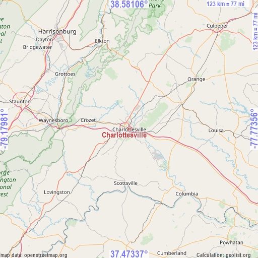
Charlottesville GPS coordinates[2]
38° 1' 45.516" North, 78° 28' 36.048" West
| Map corner | latitude | longitude |
|---|---|---|
| Upper-left | 38.58106°, | -79.17981° |
| Center: | 38.02931°, | -78.47668° |
| Lower-right: | 37.47337°, | -77.77356° |
| Map W x H: | 123.2×123.2 km | = 76.6×76.6mi |
| max Lat: | 71.29058° ⇑61.4% North |
| Charlottesville: | 38.02931° |
| min Lat: | ⇓38.6% South 19.06759° |
| min Long | Charlottesville | max Long |
| -171.73463° | -78.47668° | -66.98998° |
| W 76.9%⇐ | ⇒23.1% E |
Elevation
Elevation of Charlottesville is 141 m = 463 ft, and this is 153.8 m = 505 ft below average elevation for this country.
| Max E: |
3189 m = 10463 ft | 62.6% |
| Avg. | 294.8 m = 967 ft | |
| Charlottesville | 141 m = 463 ft | |
Min E: |
-60 m = -197 ft | 37.4% |
See also: Charlottesville elevation on elevation.city.
Geographical zone
Charlottesville is located in North temperate zone (between Tropic of Cancer and the Arctic Circle). Distance of this Northern Tropic circle is 1622.5 km =1008.2 mi to South.| Distance of | km | miles | from Charlottesville |
|---|---|---|---|
| North Pole | 5778.6 | 3590.7 | to North |
| Arctic Circle | 3172.7 | 1971.4 | to North |
| Tropic Cancer | 1622.5 | 1008.2 | to South |
| Equator | 4228.5 | 2627.5 | to South |


Nearby cities:
15 places around Charlottesville: (largest is in red/bold)
• Crimora
35.5 km =22.1 mi,  292°
292°
• Crozet
20.1 km =12.5 mi,  282°
282°
• Dooms
34.5 km =21.4 mi, 284°
• Esmont
24.8 km =15.4 mi,  207°
207°
• Gordonsville
28 km =17.4 mi,  64°
64°
• Hollymead
10.2 km =6.3 mi,  17°
17°
• Ivy
10.9 km =6.8 mi, 286°
• Lake Monticello
17.1 km =10.6 mi,  133°
133°
• Palmyra
26.5 km =16.5 mi,  135°
135°
• Pantops
2 km =1.2 mi,  75°
75°
• Ruckersville
24.5 km =15.2 mi, 22°
• Scottsville
25.7 km =16 mi,  183°
183°
• Stanardsville
30 km =18.6 mi,  6°
6°
• Twin Lakes
24.6 km =15.3 mi, 6°
• Weber City
34.9 km =21.7 mi,  150°
150°
Sources, notices
• [Note1] Compared only with cities in United States existing in our database
• [Src1] Map data: © OpenStreetMap contributors (CC-BY-SA)
• [Src2] Other city data from geonames.org with taken over terms of usage.
• [Src3] Geographical zone / Annual Mean Temperature by Robert A. Rohde @ Wikipedia
