Buckhannon geodata
Buckhannon (West Virginia) is a seat of a second-order administrative division; located in United States in America/New_York (GMT-4) time zone. With population of 5,657 people, there are 6643 cities with bigger population in this country. Compared to other cities in United States, 54.9% of cities are located further ↑North; 72.1% of cities are located further ←West and 85.7% of cities have lower elevation than Buckhannon. Note1


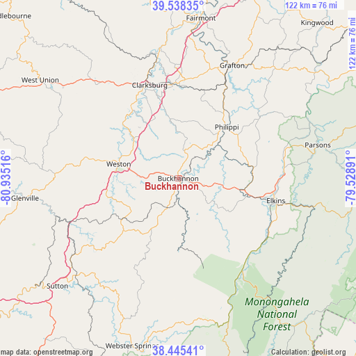
Buckhannon GPS coordinates[2]
38° 59' 38.364" North, 80° 13' 55.308" West
| Map corner | latitude | longitude |
|---|---|---|
| Upper-left | 39.53835°, | -80.93516° |
| Center: | 38.99399°, | -80.23203° |
| Lower-right: | 38.44541°, | -79.52891° |
| Map W x H: | 121.5×121.5 km | = 75.5×75.5mi |
| max Lat: | 71.29058° ⇑54.9% North |
| Buckhannon: | 38.99399° |
| min Lat: | ⇓45.1% South 19.06759° |
| min Long | Buckhannon | max Long |
| -171.73463° | -80.23203° | -66.98998° |
| W 72.1%⇐ | ⇒27.9% E |
Elevation
Elevation of Buckhannon is 437 m = 1434 ft, and this is 142.2 m = 467 ft above average elevation for this country.
| Max E: |
3189 m = 10463 ft | 14.3% |
| Buckhannon | 437 m 1434 ft | |
| Avg. | 294.8 m = 967 ft | |
Min E: |
-60 m = -197 ft | 85.7% |
See also: United States elevation on elevation.city.
Geographical zone
Buckhannon is located in North temperate zone (between Tropic of Cancer and the Arctic Circle). Distance of this Northern Tropic circle is 1729.8 km =1074.8 mi to South.| Distance of | km | miles | from Buckhannon |
|---|---|---|---|
| North Pole | 5671.3 | 3524 | to North |
| Arctic Circle | 3065.4 | 1904.8 | to North |
| Tropic Cancer | 1729.8 | 1074.8 | to South |
| Equator | 4335.7 | 2694.1 | to South |


Nearby cities:
15 places around Buckhannon: (largest is in red/bold)
• Anmoore
29.7 km =18.5 mi,  349°
349°
• Belington
25.8 km =16 mi,  82°
82°
• Beverly
35.3 km =21.9 mi,  118°
118°
• Bridgeport
32.6 km =20.3 mi,  356°
356°
• Clarksburg
33.3 km =20.7 mi,  343°
343°
• Despard
33.4 km =20.8 mi, 348°
• East Dailey
37.9 km =23.5 mi,  128°
128°
• Elkins
34.2 km =21.3 mi,  102°
102°
• Junior
24.5 km =15.2 mi,  93°
93°
• Mill Creek
37 km =23 mi,  142°
142°
• Nutter Fort
30.9 km =19.2 mi, 345°
• Philippi
24.2 km =15 mi,  43°
43°
• Stonewood
29.4 km =18.3 mi, 346°
• West Milford
27.4 km =17 mi,  327°
327°
• Weston
20.9 km =13 mi,  283°
283°
Sources, notices
• [Note1] Compared only with cities in United States existing in our database
• [Src1] Map data: © OpenStreetMap contributors (CC-BY-SA)
• [Src2] Other city data from geonames.org with taken over terms of usage.
• [Src3] Geographical zone / Annual Mean Temperature by Robert A. Rohde @ Wikipedia
