North Hills geodata
North Hills (West Virginia) is a populated place; located in United States in America/New_York (GMT-4) time zone. With population of 829 people, there are 17526 cities with bigger population in this country. Compared to other cities in United States, 52.1% of cities are located further ↑North; 67.6% of cities are located further ←West and 64.1% of cities have lower elevation than North Hills. Note1


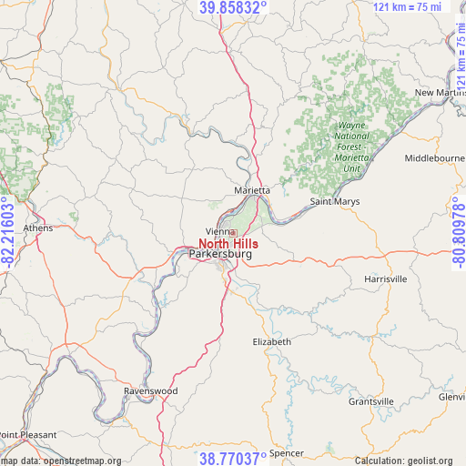
North Hills GPS coordinates[2]
39° 18' 59.256" North, 81° 30' 46.44" West
| Map corner | latitude | longitude |
|---|---|---|
| Upper-left | 39.85832°, | -82.21603° |
| Center: | 39.31646°, | -81.5129° |
| Lower-right: | 38.77037°, | -80.80978° |
| Map W x H: | 121×121 km | = 75.2×75.2mi |
| max Lat: | 71.29058° ⇑52.1% North |
| North Hills: | 39.31646° |
| min Lat: | ⇓47.9% South 19.06759° |
| min Long | North Hills | max Long |
| -171.73463° | -81.5129° | -66.98998° |
| W 67.6%⇐ | ⇒32.4% E |
Elevation
Elevation of North Hills is 258 m = 846 ft, and this is 36.8 m = 121 ft below average elevation for this country.
| Max E: |
3189 m = 10463 ft | 35.9% |
| Avg. | 294.8 m = 967 ft | |
| North Hills | 258 m = 846 ft | |
Min E: |
-60 m = -197 ft | 64.1% |
See also: United States elevation on elevation.city.
Geographical zone
North Hills is located in North temperate zone (between Tropic of Cancer and the Arctic Circle). Distance of this Northern Tropic circle is 1765.7 km =1097.2 mi to South.| Distance of | km | miles | from North Hills |
|---|---|---|---|
| North Pole | 5635.5 | 3501.7 | to North |
| Arctic Circle | 3029.6 | 1882.5 | to North |
| Tropic Cancer | 1765.7 | 1097.2 | to South |
| Equator | 4371.6 | 2716.4 | to South |


Nearby cities:
15 places around North Hills: (largest is in red/bold)
• Belmont
23 km =14.3 mi,  72°
72°
• Belpre
7 km =4.3 mi,  227°
227°
• Blennerhassett
11.6 km =7.2 mi,  239°
239°
• Boaz
5.1 km =3.2 mi,  10°
10°
• Devola
17.7 km =11 mi, 9°
• Lowell
23.7 km =14.7 mi,  1°
1°
• Lubeck
13.6 km =8.5 mi, 228°
• Marietta
12.1 km =7.5 mi,  24°
24°
• Mineral Wells
14.1 km =8.8 mi,  186°
186°
• Newport
26 km =16.2 mi, 71°
• Parkersburg
6.9 km =4.3 mi,  217°
217°
• Reno
11.9 km =7.4 mi,  58°
58°
• Vienna
3.3 km =2.1 mi,  291°
291°
• Washington
15 km =9.3 mi,  245°
245°
• Williamstown
10.9 km =6.8 mi,  30°
30°
Sources, notices
• [Note1] Compared only with cities in United States existing in our database
• [Src1] Map data: © OpenStreetMap contributors (CC-BY-SA)
• [Src2] Other city data from geonames.org with taken over terms of usage.
• [Src3] Geographical zone / Annual Mean Temperature by Robert A. Rohde @ Wikipedia
