Grundy Center geodata
Grundy Center (Iowa) is a seat of a second-order administrative division; located in United States in America/Chicago (GMT-5) time zone. With population of 2,714 people, there are 10151 cities with bigger population in this country. Compared to other cities in United States, 78.6% of cities are located further ↓South; 65.8% of cities are located further →East and 75.1% of cities have lower elevation than Grundy Center. Note1


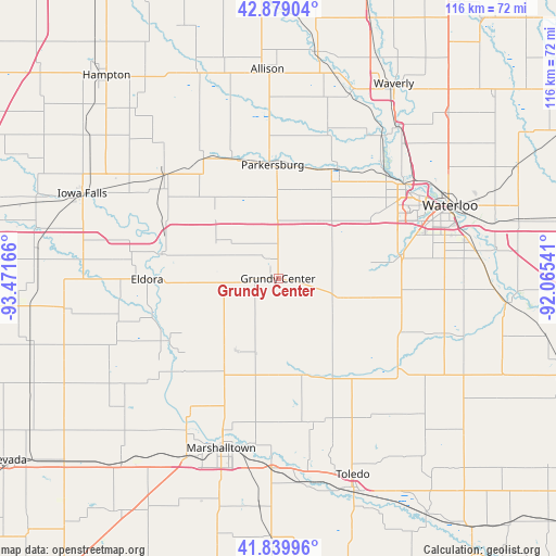
Grundy Center GPS coordinates[2]
42° 21' 41.94" North, 92° 46' 6.708" West
| Map corner | latitude | longitude |
|---|---|---|
| Upper-left | 42.87904°, | -93.47166° |
| Center: | 42.36165°, | -92.76853° |
| Lower-right: | 41.83996°, | -92.06541° |
| Map W x H: | 115.5×115.5 km | = 71.8×71.8mi |
| max Lat: | 71.29058° ⇑21.4% North |
| Grundy Center: | 42.36165° |
| min Lat: | ⇓78.6% South 19.06759° |
| min Long | Grundy Center | max Long |
| -171.73463° | -92.76853° | -66.98998° |
| W 34.2%⇐ | ⇒65.8% E |
Elevation
Elevation of Grundy Center is 314 m = 1030 ft, and this is 19.2 m = 63 ft above average elevation for this country.
| Max E: |
3189 m = 10463 ft | 24.9% |
| Grundy Center | 314 m 1030 ft | |
| Avg. | 294.8 m = 967 ft | |
Min E: |
-60 m = -197 ft | 75.1% |
See also: United States elevation on elevation.city.
Geographical zone
Grundy Center is located in North temperate zone (between Tropic of Cancer and the Arctic Circle). Distance of this Northern Tropic circle is 2104.3 km =1307.6 mi to South.| Distance of | km | miles | from Grundy Center |
|---|---|---|---|
| North Pole | 5296.9 | 3291.3 | to North |
| Arctic Circle | 2691 | 1672.1 | to North |
| Tropic Cancer | 2104.3 | 1307.6 | to South |
| Equator | 4710.2 | 2926.8 | to South |


Nearby cities:
15 places around Grundy Center: (largest is in red/bold)
• Ackley
31.7 km =19.7 mi,  312°
312°
• Aplington
26.5 km =16.5 mi,  338°
338°
• Cedar Falls
32.3 km =20.1 mi,  55°
55°
• Conrad
17.6 km =10.9 mi,  209°
209°
• Dike
16.2 km =10.1 mi,  45°
45°
• Eldora
27.2 km =16.9 mi,  269°
269°
• Garwin
30.8 km =19.1 mi,  165°
165°
• Gladbrook
19.8 km =12.3 mi, 167°
• Hudson
26.2 km =16.3 mi,  78°
78°
• Marshalltown
36.6 km =22.7 mi,  198°
198°
• New Hartford
25.8 km =16 mi,  27°
27°
• Parkersburg
24 km =14.9 mi,  356°
356°
• Reinbeck
14.5 km =9 mi,  106°
106°
• Traer
31.2 km =19.4 mi,  126°
126°
• Wellsburg
17.7 km =11 mi, 307°
Sources, notices
• [Note1] Compared only with cities in United States existing in our database
• [Src1] Map data: © OpenStreetMap contributors (CC-BY-SA)
• [Src2] Other city data from geonames.org with taken over terms of usage.
• [Src3] Geographical zone / Annual Mean Temperature by Robert A. Rohde @ Wikipedia
