Nora Springs geodata
Nora Springs (Iowa) is a populated place; located in United States in America/Chicago (GMT-5) time zone. With population of 1,389 people, there are 14162 cities with bigger population in this country. Compared to other cities in United States, 84.4% of cities are located further ↓South; 66.3% of cities are located further →East and 77.6% of cities have lower elevation than Nora Springs. Note1


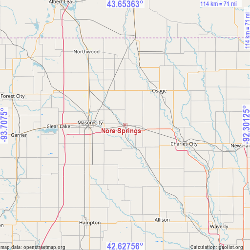
Nora Springs GPS coordinates[2]
43° 8' 33.9" North, 93° 0' 15.732" West
| Map corner | latitude | longitude |
|---|---|---|
| Upper-left | 43.65363°, | -93.7075° |
| Center: | 43.14275°, | -93.00437° |
| Lower-right: | 42.62756°, | -92.30125° |
| Map W x H: | 114.1×114.1 km | = 70.9×70.9mi |
| max Lat: | 71.29058° ⇑15.6% North |
| Nora Springs: | 43.14275° |
| min Lat: | ⇓84.4% South 19.06759° |
| min Long | Nora Springs | max Long |
| -171.73463° | -93.00437° | -66.98998° |
| W 33.7%⇐ | ⇒66.3% E |
Elevation
Elevation of Nora Springs is 333 m = 1093 ft, and this is 38.2 m = 125 ft above average elevation for this country.
| Max E: |
3189 m = 10463 ft | 22.4% |
| Nora Springs | 333 m 1093 ft | |
| Avg. | 294.8 m = 967 ft | |
Min E: |
-60 m = -197 ft | 77.6% |
See also: United States elevation on elevation.city.
Geographical zone
Nora Springs is located in North temperate zone (between Tropic of Cancer and the Arctic Circle). Distance of this Northern Tropic circle is 2191.1 km =1361.5 mi to South.| Distance of | km | miles | from Nora Springs |
|---|---|---|---|
| North Pole | 5210 | 3237.3 | to North |
| Arctic Circle | 2604.1 | 1618.1 | to North |
| Tropic Cancer | 2191.1 | 1361.5 | to South |
| Equator | 4797 | 2980.7 | to South |


Nearby cities:
15 places around Nora Springs: (largest is in red/bold)
• Charles City
28.3 km =17.6 mi,  107°
107°
• Clear Lake
30.4 km =18.9 mi,  269°
269°
• Dumont
43.5 km =27 mi,  176°
176°
• Greene
32 km =19.9 mi,  149°
149°
• Lyle
40.6 km =25.2 mi,  6°
6°
• Manly
22.7 km =14.1 mi,  315°
315°
• Mason City
16 km =9.9 mi, 274°
• Nashua
43.5 km =27 mi,  119°
119°
• Northwood
37.8 km =23.5 mi,  332°
332°
• Osage
22.2 km =13.8 mi,  44°
44°
• Rockford
11 km =6.8 mi,  155°
155°
• Rockwell
23.2 km =14.4 mi,  221°
221°
• Saint Ansgar
27.1 km =16.8 mi, 14°
• Sheffield
32.6 km =20.3 mi,  211°
211°
• Ventura
38.5 km =23.9 mi, 267°
Sources, notices
• [Note1] Compared only with cities in United States existing in our database
• [Src1] Map data: © OpenStreetMap contributors (CC-BY-SA)
• [Src2] Other city data from geonames.org with taken over terms of usage.
• [Src3] Geographical zone / Annual Mean Temperature by Robert A. Rohde @ Wikipedia
