Perry geodata
Perry (Iowa) is a populated place; located in United States in America/Chicago (GMT-5) time zone. With population of 8,089 people, there are 5239 cities with bigger population in this country. Compared to other cities in United States, 74.2% of cities are located further ↓South; 68.9% of cities are located further →East and 70.9% of cities have lower elevation than Perry. Note1


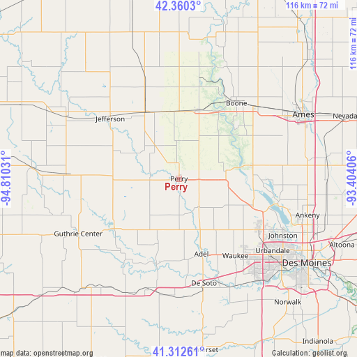
Perry GPS coordinates[2]
41° 50' 18.96" North, 94° 6' 25.848" West
| Map corner | latitude | longitude |
|---|---|---|
| Upper-left | 42.3603°, | -94.81031° |
| Center: | 41.8386°, | -94.10718° |
| Lower-right: | 41.31261°, | -93.40406° |
| Map W x H: | 116.5×116.5 km | = 72.4×72.4mi |
| max Lat: | 71.29058° ⇑25.8% North |
| Perry: | 41.8386° |
| min Lat: | ⇓74.2% South 19.06759° |
| min Long | Perry | max Long |
| -171.73463° | -94.10718° | -66.98998° |
| W 31.1%⇐ | ⇒68.9% E |
Elevation
Elevation of Perry is 290 m = 951 ft, and this is 4.8 m = 16 ft below average elevation for this country.
| Max E: |
3189 m = 10463 ft | 29.1% |
| Avg. | 294.8 m = 967 ft | |
| Perry | 290 m = 951 ft | |
Min E: |
-60 m = -197 ft | 70.9% |
See also: United States elevation on elevation.city.
Geographical zone
Perry is located in North temperate zone (between Tropic of Cancer and the Arctic Circle). Distance of this Northern Tropic circle is 2046.1 km =1271.4 mi to South.| Distance of | km | miles | from Perry |
|---|---|---|---|
| North Pole | 5355 | 3327.4 | to North |
| Arctic Circle | 2749.2 | 1708.3 | to North |
| Tropic Cancer | 2046.1 | 1271.4 | to South |
| Equator | 4652 | 2890.6 | to South |


Nearby cities:
15 places around Perry: (largest is in red/bold)
• Adel
26 km =16.2 mi,  163°
163°
• Boone
30.9 km =19.2 mi,  37°
37°
• Centerville
31.6 km =19.6 mi,  26°
26°
• Dallas Center
21 km =13 mi,  144°
144°
• Grand Junction
24.1 km =15 mi,  332°
332°
• Granger
25 km =15.5 mi,  110°
110°
• Grimes
31.1 km =19.3 mi,  122°
122°
• Jefferson
29.8 km =18.5 mi,  311°
311°
• Lake Panorama
27.4 km =17 mi,  238°
238°
• Madrid
23.9 km =14.9 mi,  79°
79°
• Ogden
23.2 km =14.4 mi,  16°
16°
• Panora
26.8 km =16.7 mi,  232°
232°
• Redfield
28.7 km =17.8 mi,  194°
194°
• Waukee
31.2 km =19.4 mi, 143°
• Woodward
15.5 km =9.6 mi, 82°
Sources, notices
• [Note1] Compared only with cities in United States existing in our database
• [Src1] Map data: © OpenStreetMap contributors (CC-BY-SA)
• [Src2] Other city data from geonames.org with taken over terms of usage.
• [Src3] Geographical zone / Annual Mean Temperature by Robert A. Rohde @ Wikipedia
