Tama geodata
Tama (Iowa) is a populated place; located in United States in America/Chicago (GMT-5) time zone. With population of 2,819 people, there are 9963 cities with bigger population in this country. Compared to other cities in United States, 75.4% of cities are located further ↓South; 65.4% of cities are located further →East and 64.1% of cities have lower elevation than Tama. Note1


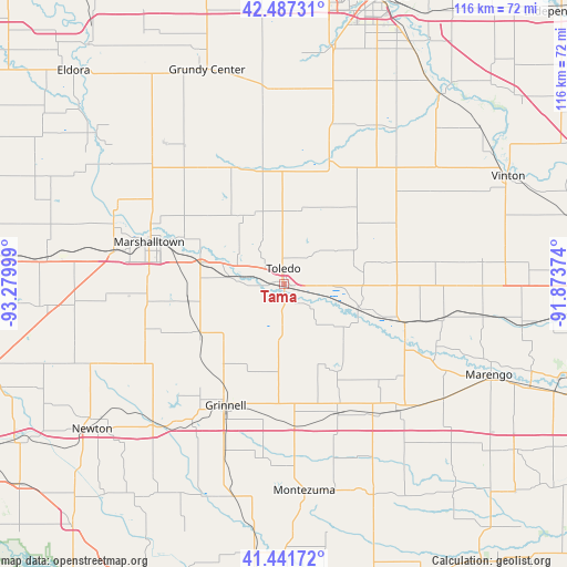
Tama GPS coordinates[2]
41° 57' 59.976" North, 92° 34' 36.696" West
| Map corner | latitude | longitude |
|---|---|---|
| Upper-left | 42.48731°, | -93.27999° |
| Center: | 41.96666°, | -92.57686° |
| Lower-right: | 41.44172°, | -91.87374° |
| Map W x H: | 116.3×116.3 km | = 72.3×72.3mi |
| max Lat: | 71.29058° ⇑24.6% North |
| Tama: | 41.96666° |
| min Lat: | ⇓75.4% South 19.06759° |
| min Long | Tama | max Long |
| -171.73463° | -92.57686° | -66.98998° |
| W 34.6%⇐ | ⇒65.4% E |
Elevation
Elevation of Tama is 258 m = 846 ft, and this is 36.8 m = 121 ft below average elevation for this country.
| Max E: |
3189 m = 10463 ft | 35.9% |
| Avg. | 294.8 m = 967 ft | |
| Tama | 258 m = 846 ft | |
Min E: |
-60 m = -197 ft | 64.1% |
See also: United States elevation on elevation.city.
Geographical zone
Tama is located in North temperate zone (between Tropic of Cancer and the Arctic Circle). Distance of this Northern Tropic circle is 2060.3 km =1280.2 mi to South.| Distance of | km | miles | from Tama |
|---|---|---|---|
| North Pole | 5340.8 | 3318.6 | to North |
| Arctic Circle | 2734.9 | 1699.4 | to North |
| Tropic Cancer | 2060.3 | 1280.2 | to South |
| Equator | 4666.3 | 2899.5 | to South |


Nearby cities:
15 places around Tama: (largest is in red/bold)
• Belle Plaine
25.9 km =16.1 mi,  107°
107°
• Brooklyn
28.1 km =17.5 mi,  157°
157°
• Conrad
37.8 km =23.5 mi,  319°
319°
• Dysart
31.9 km =19.8 mi,  44°
44°
• Garwin
16.3 km =10.1 mi,  329°
329°
• Gilman
20.1 km =12.5 mi,  240°
240°
• Gladbrook
27.1 km =16.8 mi,  335°
335°
• Grinnell
27.6 km =17.1 mi,  205°
205°
• Kellogg
38.9 km =24.2 mi,  224°
224°
• Keystone
31.6 km =19.6 mi,  83°
83°
• Le Grand
17 km =10.6 mi,  285°
285°
• Marshalltown
28.9 km =18 mi, 288°
• Toledo
3.2 km =2 mi,  0°
0°
• Traer
26.9 km =16.7 mi,  20°
20°
• Victor
34.9 km =21.7 mi,  138°
138°
Sources, notices
• [Note1] Compared only with cities in United States existing in our database
• [Src1] Map data: © OpenStreetMap contributors (CC-BY-SA)
• [Src2] Other city data from geonames.org with taken over terms of usage.
• [Src3] Geographical zone / Annual Mean Temperature by Robert A. Rohde @ Wikipedia
