Belmont Cragin geodata
Belmont Cragin (Illinois) is a section of populated place; located in United States in America/Chicago (GMT-5) time zone. With population of 79,159 people, there are 501 cities with bigger population in this country. Compared to other cities in United States, 75.1% of cities are located further ↓South; 51.8% of cities are located further →East and 52.2% of cities have higher elevation than Belmont Cragin. Note1


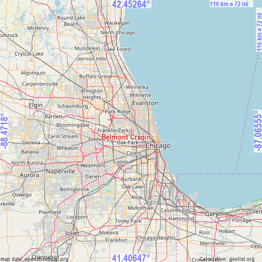
Belmont Cragin GPS coordinates[2]
41° 55' 54.12" North, 87° 46' 7.212" West
| Map corner | latitude | longitude |
|---|---|---|
| Upper-left | 42.45264°, | -88.4718° |
| Center: | 41.9317°, | -87.76867° |
| Lower-right: | 41.40647°, | -87.06555° |
| Map W x H: | 116.3×116.3 km | = 72.3×72.3mi |
| max Lat: | 71.29058° ⇑24.9% North |
| Belmont Cragin: | 41.9317° |
| min Lat: | ⇓75.1% South 19.06759° |
| min Long | Belmont Cragin | max Long |
| -171.73463° | -87.76867° | -66.98998° |
| W 48.2%⇐ | ⇒51.8% E |
Elevation
Elevation of Belmont Cragin is 190 m = 623 ft, and this is 104.8 m = 344 ft below average elevation for this country.
| Max E: |
3189 m = 10463 ft | 52.2% |
| Avg. | 294.8 m = 967 ft | |
| Belmont Cragin | 190 m = 623 ft | |
Min E: |
-60 m = -197 ft | 47.8% |
See also: Belmont Cragin elevation on elevation.city.
Geographical zone
Belmont Cragin is located in North temperate zone (between Tropic of Cancer and the Arctic Circle). Distance of this Northern Tropic circle is 2056.4 km =1277.8 mi to South.| Distance of | km | miles | from Belmont Cragin |
|---|---|---|---|
| North Pole | 5344.7 | 3321 | to North |
| Arctic Circle | 2738.8 | 1701.8 | to North |
| Tropic Cancer | 2056.4 | 1277.8 | to South |
| Equator | 4662.4 | 2897.1 | to South |


Nearby cities:
15 places around Belmont Cragin: (largest is in red/bold)
• Albany Park
5.5 km =3.4 mi,  42°
42°
• Avondale
4.8 km =3 mi,  80°
80°
• East Garfield Park
7.9 km =4.9 mi,  136°
136°
• Elmwood Park
3.6 km =2.2 mi,  250°
250°
• Forest Park
6.9 km =4.3 mi,  212°
212°
• Harwood Heights
5.1 km =3.2 mi,  320°
320°
• Irving Park
3.6 km =2.2 mi,  47°
47°
• Logan Square
5.8 km =3.6 mi,  99°
99°
• Norridge
6 km =3.7 mi,  305°
305°
• North Center
7.8 km =4.8 mi,  71°
71°
• Oak Park
5.4 km =3.4 mi,  194°
194°
• Portage Park
2.9 km =1.8 mi,  5°
5°
• River Forest
5.3 km =3.3 mi,  224°
224°
• River Grove
5.6 km =3.5 mi,  263°
263°
• West Garfield Park
6.6 km =4.1 mi,  150°
150°
Sources, notices
• [Note1] Compared only with cities in United States existing in our database
• [Src1] Map data: © OpenStreetMap contributors (CC-BY-SA)
• [Src2] Other city data from geonames.org with taken over terms of usage.
• [Src3] Geographical zone / Annual Mean Temperature by Robert A. Rohde @ Wikipedia
