Davis Junction geodata
Davis Junction (Illinois) is a populated place; located in United States in America/Chicago (GMT-5) time zone. With population of 2,270 people, there are 11160 cities with bigger population in this country. Compared to other cities in United States, 76.6% of cities are located further ↓South; 56.4% of cities are located further →East and 61.4% of cities have lower elevation than Davis Junction. Note1


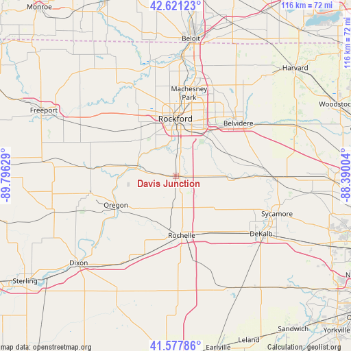
Davis Junction GPS coordinates[2]
42° 6' 6.084" North, 89° 5' 35.376" West
| Map corner | latitude | longitude |
|---|---|---|
| Upper-left | 42.62123°, | -89.79629° |
| Center: | 42.10169°, | -89.09316° |
| Lower-right: | 41.57786°, | -88.39004° |
| Map W x H: | 116×116 km | = 72.1×72.1mi |
| max Lat: | 71.29058° ⇑23.4% North |
| Davis Junction: | 42.10169° |
| min Lat: | ⇓76.6% South 19.06759° |
| min Long | Davis Junction | max Long |
| -171.73463° | -89.09316° | -66.98998° |
| W 43.6%⇐ | ⇒56.4% E |
Elevation
Elevation of Davis Junction is 246 m = 807 ft, and this is 48.8 m = 160 ft below average elevation for this country.
| Max E: |
3189 m = 10463 ft | 38.6% |
| Avg. | 294.8 m = 967 ft | |
| Davis Junction | 246 m = 807 ft | |
Min E: |
-60 m = -197 ft | 61.4% |
See also: United States elevation on elevation.city.
Geographical zone
Davis Junction is located in North temperate zone (between Tropic of Cancer and the Arctic Circle). Distance of this Northern Tropic circle is 2075.4 km =1289.6 mi to South.| Distance of | km | miles | from Davis Junction |
|---|---|---|---|
| North Pole | 5325.8 | 3309.3 | to North |
| Arctic Circle | 2719.9 | 1690.1 | to North |
| Tropic Cancer | 2075.4 | 1289.6 | to South |
| Equator | 4681.3 | 2908.8 | to South |


Nearby cities:
15 places around Davis Junction: (largest is in red/bold)
• Belvidere
27.3 km =17 mi,  48°
48°
• Byron
13.7 km =8.5 mi,  281°
281°
• Cherry Valley
19 km =11.8 mi,  38°
38°
• Creston
21.8 km =13.5 mi,  150°
150°
• Edgewood
21 km =13 mi, 42°
• Hillcrest
16.9 km =10.5 mi,  171°
171°
• Kirkland
20 km =12.4 mi,  92°
92°
• Loves Park
24.4 km =15.2 mi,  6°
6°
• Malta
27.1 km =16.8 mi,  134°
134°
• New Milford
9.7 km =6 mi, 12°
• Oregon
22 km =13.7 mi,  243°
243°
• Rochelle
19.9 km =12.4 mi, 174°
• Rockford
18.8 km =11.7 mi,  359°
359°
• Stillman Valley
7.1 km =4.4 mi,  274°
274°
• Winnebago
22 km =13.7 mi,  326°
326°
Sources, notices
• [Note1] Compared only with cities in United States existing in our database
• [Src1] Map data: © OpenStreetMap contributors (CC-BY-SA)
• [Src2] Other city data from geonames.org with taken over terms of usage.
• [Src3] Geographical zone / Annual Mean Temperature by Robert A. Rohde @ Wikipedia
