Edgewater geodata
Edgewater (Illinois) is a section of populated place; located in United States in America/Chicago (GMT-5) time zone. With population of 54,873 people, there are 843 cities with bigger population in this country. Compared to other cities in United States, 75.5% of cities are located further ↓South; 51.3% of cities are located further →East and 53.9% of cities have higher elevation than Edgewater. Note1


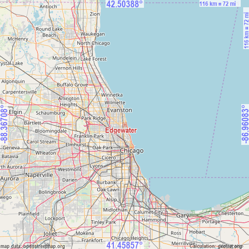
Edgewater GPS coordinates[2]
41° 59' 0.132" North, 87° 39' 50.22" West
| Map corner | latitude | longitude |
|---|---|---|
| Upper-left | 42.50388°, | -88.36708° |
| Center: | 41.98337°, | -87.66395° |
| Lower-right: | 41.45857°, | -86.96083° |
| Map W x H: | 116.2×116.2 km | = 72.2×72.2mi |
| max Lat: | 71.29058° ⇑24.5% North |
| Edgewater: | 41.98337° |
| min Lat: | ⇓75.5% South 19.06759° |
| min Long | Edgewater | max Long |
| -171.73463° | -87.66395° | -66.98998° |
| W 48.7%⇐ | ⇒51.3% E |
Elevation
Elevation of Edgewater is 184 m = 604 ft, and this is 110.8 m = 364 ft below average elevation for this country.
| Max E: |
3189 m = 10463 ft | 53.9% |
| Avg. | 294.8 m = 967 ft | |
| Edgewater | 184 m = 604 ft | |
Min E: |
-60 m = -197 ft | 46.1% |
See also: Edgewater elevation on elevation.city.
Geographical zone
Edgewater is located in North temperate zone (between Tropic of Cancer and the Arctic Circle). Distance of this Northern Tropic circle is 2062.2 km =1281.4 mi to South.| Distance of | km | miles | from Edgewater |
|---|---|---|---|
| North Pole | 5338.9 | 3317.4 | to North |
| Arctic Circle | 2733.1 | 1698.3 | to North |
| Tropic Cancer | 2062.2 | 1281.4 | to South |
| Equator | 4668.1 | 2900.6 | to South |


Nearby cities:
15 places around Edgewater: (largest is in red/bold)
• Albany Park
5.2 km =3.2 mi,  251°
251°
• Avondale
6.3 km =3.9 mi,  218°
218°
• Evanston
6.8 km =4.2 mi,  341°
341°
• Irving Park
6.9 km =4.3 mi,  240°
240°
• Lincoln Park
7 km =4.3 mi,  168°
168°
• Lincoln Square
2.2 km =1.4 mi, 248°
• Lincolnwood
5.9 km =3.7 mi,  293°
293°
• Logan Square
7.3 km =4.5 mi,  203°
203°
• Near North Side
9.6 km =6 mi, 165°
• North Center
3.5 km =2.2 mi, 200°
• Portage Park
8.8 km =5.5 mi, 251°
• Rogers Park
2.8 km =1.7 mi,  355°
355°
• Skokie
8 km =5 mi,  314°
314°
• Uptown
2.2 km =1.4 mi,  154°
154°
• West Ridge
3 km =1.9 mi, 307°
Sources, notices
• [Note1] Compared only with cities in United States existing in our database
• [Src1] Map data: © OpenStreetMap contributors (CC-BY-SA)
• [Src2] Other city data from geonames.org with taken over terms of usage.
• [Src3] Geographical zone / Annual Mean Temperature by Robert A. Rohde @ Wikipedia
