Geneva geodata
Geneva (Indiana) is a populated place; located in United States in America/Indiana/Indianapolis (GMT-4) time zone. With population of 1,320 people, there are 14488 cities with bigger population in this country. Compared to other cities in United States, 59.9% of cities are located further ↓South; 56% of cities are located further ←West and 64.1% of cities have lower elevation than Geneva. Note1


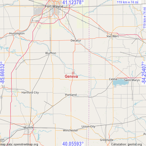
Geneva GPS coordinates[2]
40° 35' 31.164" North, 84° 57' 25.884" West
| Map corner | latitude | longitude |
|---|---|---|
| Upper-left | 41.12378°, | -85.66032° |
| Center: | 40.59199°, | -84.95719° |
| Lower-right: | 40.05593°, | -84.25407° |
| Map W x H: | 118.7×118.7 km | = 73.8×73.8mi |
| max Lat: | 71.29058° ⇑40.1% North |
| Geneva: | 40.59199° |
| min Lat: | ⇓59.9% South 19.06759° |
| min Long | Geneva | max Long |
| -171.73463° | -84.95719° | -66.98998° |
| W 56%⇐ | ⇒44% E |
Elevation
Elevation of Geneva is 258 m = 846 ft, and this is 36.8 m = 121 ft below average elevation for this country.
| Max E: |
3189 m = 10463 ft | 35.9% |
| Avg. | 294.8 m = 967 ft | |
| Geneva | 258 m = 846 ft | |
Min E: |
-60 m = -197 ft | 64.1% |
See also: United States elevation on elevation.city.
Geographical zone
Geneva is located in North temperate zone (between Tropic of Cancer and the Arctic Circle). Distance of this Northern Tropic circle is 1907.5 km =1185.3 mi to South.| Distance of | km | miles | from Geneva |
|---|---|---|---|
| North Pole | 5493.7 | 3413.6 | to North |
| Arctic Circle | 2887.8 | 1794.4 | to North |
| Tropic Cancer | 1907.5 | 1185.3 | to South |
| Equator | 4513.4 | 2804.5 | to South |


Nearby cities:
15 places around Geneva: (largest is in red/bold)
• Berne
7.3 km =4.5 mi,  3°
3°
• Bluffton
24.4 km =15.2 mi,  312°
312°
• Celina
33 km =20.5 mi,  98°
98°
• Coldwater
30.5 km =19 mi,  114°
114°
• Decatur
26.6 km =16.5 mi,  5°
5°
• Dunkirk
32.2 km =20 mi,  221°
221°
• Fort Recovery
25.1 km =15.6 mi,  142°
142°
• Monroe
17.1 km =10.6 mi, 5°
• Montpelier
27.4 km =17 mi,  261°
261°
• Pennville
19.5 km =12.1 mi,  235°
235°
• Portland
17.6 km =10.9 mi,  185°
185°
• Redkey
31.6 km =19.6 mi,  211°
211°
• Ridgeville
34.2 km =21.3 mi, 190°
• Rockford
28.3 km =17.6 mi,  67°
67°
• Saint Henry
33.1 km =20.6 mi,  125°
125°
Sources, notices
• [Note1] Compared only with cities in United States existing in our database
• [Src1] Map data: © OpenStreetMap contributors (CC-BY-SA)
• [Src2] Other city data from geonames.org with taken over terms of usage.
• [Src3] Geographical zone / Annual Mean Temperature by Robert A. Rohde @ Wikipedia
