Belchertown geodata
Belchertown (Massachusetts) is a populated place; located in United States in America/New_York (GMT-4) time zone. With population of 2,899 people, there are 9803 cities with bigger population in this country. Compared to other cities in United States, 78% of cities are located further ↓South; 95% of cities are located further ←West and 53.1% of cities have higher elevation than Belchertown. Note1
Administrative division(s):
- Level 1: Massachusetts
- Level 2: Hampshire County
- Level 3: Town of Belchertown


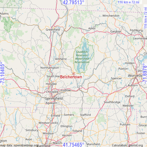
Belchertown GPS coordinates[2]
42° 16' 37.344" North, 72° 24' 3.312" West
| Map corner | latitude | longitude |
|---|---|---|
| Upper-left | 42.79513°, | -73.10405° |
| Center: | 42.27704°, | -72.40092° |
| Lower-right: | 41.75465°, | -71.6978° |
| Map W x H: | 115.7×115.7 km | = 71.9×71.9mi |
| max Lat: | 71.29058° ⇑22% North |
| Belchertown: | 42.27704° |
| min Lat: | ⇓78% South 19.06759° |
| min Long | Belchertown | max Long |
| -171.73463° | -72.40092° | -66.98998° |
| W 95%⇐ | ⇒5% E |
Elevation
Elevation of Belchertown is 187 m = 614 ft, and this is 107.8 m = 354 ft below average elevation for this country.
| Max E: |
3189 m = 10463 ft | 53.1% |
| Avg. | 294.8 m = 967 ft | |
| Belchertown | 187 m = 614 ft | |
Min E: |
-60 m = -197 ft | 46.9% |
See also: United States elevation on elevation.city.
Geographical zone
Belchertown is located in North temperate zone (between Tropic of Cancer and the Arctic Circle). Distance of this Northern Tropic circle is 2094.8 km =1301.6 mi to South.| Distance of | km | miles | from Belchertown |
|---|---|---|---|
| North Pole | 5306.3 | 3297.2 | to North |
| Arctic Circle | 2700.4 | 1678 | to North |
| Tropic Cancer | 2094.8 | 1301.6 | to South |
| Equator | 4700.8 | 2920.9 | to South |


Nearby cities:
15 places around Belchertown: (largest is in red/bold)
• Amherst
13.9 km =8.6 mi,  316°
316°
• Amherst Center
14.6 km =9.1 mi, 318°
• Bondsville
8.5 km =5.3 mi,  147°
147°
• Granby
9.8 km =6.1 mi,  256°
256°
• Hadley
17 km =10.6 mi,  295°
295°
• Hardwick
18.4 km =11.4 mi,  63°
63°
• Ludlow
14.4 km =8.9 mi,  205°
205°
• North Amherst
18.3 km =11.4 mi, 324°
• Palmer
14.5 km =9 mi,  155°
155°
• Pelham
12.9 km =8 mi,  358°
358°
• South Amherst
11.1 km =6.9 mi,  309°
309°
• South Hadley
14.4 km =8.9 mi, 261°
• Three Rivers
11.2 km =7 mi, 162°
• Ware
13.4 km =8.3 mi,  98°
98°
• Wilbraham
17.2 km =10.7 mi,  188°
188°
Sources, notices
• [Note1] Compared only with cities in United States existing in our database
• [Src1] Map data: © OpenStreetMap contributors (CC-BY-SA)
• [Src2] Other city data from geonames.org with taken over terms of usage.
• [Src3] Geographical zone / Annual Mean Temperature by Robert A. Rohde @ Wikipedia
