Sagamore geodata
Sagamore (Massachusetts) is a populated place; located in United States in America/New_York (GMT-4) time zone. With population of 3,623 people, there are 8694 cities with bigger population in this country. Compared to other cities in United States, 73.6% of cities are located further ↓South; 98.4% of cities are located further ←West and 93% of cities have higher elevation than Sagamore. Note1
Administrative division(s):
- Level 1: Massachusetts
- Level 2: Barnstable County
- Level 3: Town of Bourne


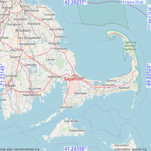
Sagamore GPS coordinates[2]
41° 46' 12.396" North, 70° 31' 42.096" West
| Map corner | latitude | longitude |
|---|---|---|
| Upper-left | 42.29237°, | -71.23149° |
| Center: | 41.77011°, | -70.52836° |
| Lower-right: | 41.24356°, | -69.82524° |
| Map W x H: | 116.6×116.6 km | = 72.5×72.5mi |
| max Lat: | 71.29058° ⇑26.4% North |
| Sagamore: | 41.77011° |
| min Lat: | ⇓73.6% South 19.06759° |
| min Long | Sagamore | max Long |
| -171.73463° | -70.52836° | -66.98998° |
| W 98.4%⇐ | ⇒1.6% E |
Elevation
Elevation of Sagamore is 11 m = 36 ft, and this is 283.8 m = 931 ft below average elevation for this country.
| Max E: |
3189 m = 10463 ft | 93% |
| Avg. | 294.8 m = 967 ft | |
| Sagamore | 11 m = 36 ft | |
Min E: |
-60 m = -197 ft | 7% |
See also: United States elevation on elevation.city.
Geographical zone
Sagamore is located in North temperate zone (between Tropic of Cancer and the Arctic Circle). Distance of this Northern Tropic circle is 2038.5 km =1266.7 mi to South.| Distance of | km | miles | from Sagamore |
|---|---|---|---|
| North Pole | 5362.7 | 3332.2 | to North |
| Arctic Circle | 2756.8 | 1713 | to North |
| Tropic Cancer | 2038.5 | 1266.7 | to South |
| Equator | 4644.4 | 2885.9 | to South |


Nearby cities:
15 places around Sagamore: (largest is in red/bold)
• Bourne
6.7 km =4.2 mi,  241°
241°
• Buzzards Bay
7.9 km =4.9 mi,  249°
249°
• East Sandwich
7.1 km =4.4 mi,  116°
116°
• Forestdale
9 km =5.6 mi,  164°
164°
• Marstons Mills
15.7 km =9.8 mi,  143°
143°
• Mashpee
14.1 km =8.8 mi, 163°
• Monument Beach
8.9 km =5.5 mi,  230°
230°
• North Falmouth
15.7 km =9.8 mi,  208°
208°
• Onset
11.2 km =7 mi, 253°
• Pocasset
11.8 km =7.3 mi,  217°
217°
• Sandwich
3.1 km =1.9 mi,  113°
113°
• The Pinehills
14.4 km =8.9 mi,  335°
335°
• Wareham Center
16.4 km =10.2 mi,  268°
268°
• West Barnstable
14.6 km =9.1 mi, 119°
• White Island Shores
9.4 km =5.8 mi,  290°
290°
Sources, notices
• [Note1] Compared only with cities in United States existing in our database
• [Src1] Map data: © OpenStreetMap contributors (CC-BY-SA)
• [Src2] Other city data from geonames.org with taken over terms of usage.
• [Src3] Geographical zone / Annual Mean Temperature by Robert A. Rohde @ Wikipedia
