West Barnstable geodata
West Barnstable (Massachusetts) is a populated place; located in United States in America/New_York (GMT-4) time zone. With population of 1,508 people, there are 13621 cities with bigger population in this country. Compared to other cities in United States, 73% of cities are located further ↓South; 98.5% of cities are located further ←West and 91% of cities have higher elevation than West Barnstable. Note1
Administrative division(s):
- Level 1: Massachusetts
- Level 2: Barnstable County
- Level 3: City of Barnstable Town


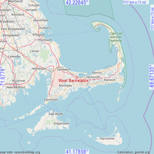
West Barnstable GPS coordinates[2]
41° 42' 20.376" North, 70° 22' 28.092" West
| Map corner | latitude | longitude |
|---|---|---|
| Upper-left | 42.22845°, | -71.0776° |
| Center: | 41.70566°, | -70.37447° |
| Lower-right: | 41.17858°, | -69.67135° |
| Map W x H: | 116.7×116.7 km | = 72.5×72.5mi |
| max Lat: | 71.29058° ⇑27% North |
| West Barnstable: | 41.70566° |
| min Lat: | ⇓73% South 19.06759° |
| min Long | West Barnstable | max Long |
| -171.73463° | -70.37447° | -66.98998° |
| W 98.5%⇐ | ⇒1.5% E |
Elevation
Elevation of West Barnstable is 14 m = 46 ft, and this is 280.8 m = 921 ft below average elevation for this country.
| Max E: |
3189 m = 10463 ft | 91% |
| Avg. | 294.8 m = 967 ft | |
| West Barnstable | 14 m = 46 ft | |
Min E: |
-60 m = -197 ft | 9% |
See also: United States elevation on elevation.city.
Geographical zone
West Barnstable is located in North temperate zone (between Tropic of Cancer and the Arctic Circle). Distance of this Northern Tropic circle is 2031.3 km =1262.2 mi to South.| Distance of | km | miles | from West Barnstable |
|---|---|---|---|
| North Pole | 5369.8 | 3336.6 | to North |
| Arctic Circle | 2763.9 | 1717.4 | to North |
| Tropic Cancer | 2031.3 | 1262.2 | to South |
| Equator | 4637.2 | 2881.4 | to South |


Nearby cities:
15 places around West Barnstable: (largest is in red/bold)
• Barnstable
6.3 km =3.9 mi,  95°
95°
• Centerville
6.7 km =4.2 mi,  160°
160°
• Cotuit
11.2 km =7 mi,  207°
207°
• East Sandwich
7.6 km =4.7 mi,  302°
302°
• Forestdale
10.5 km =6.5 mi,  261°
261°
• Hyannis
9.6 km =6 mi,  127°
127°
• Marstons Mills
6.5 km =4 mi, 212°
• Mashpee
10.9 km =6.8 mi,  234°
234°
• Mashpee Neck
13 km =8.1 mi,  215°
215°
• Osterville
8.6 km =5.3 mi,  186°
186°
• Sagamore
14.6 km =9.1 mi, 299°
• Sandwich
11.6 km =7.2 mi, 300°
• West Yarmouth
12.7 km =7.9 mi,  119°
119°
• Yarmouth
12.1 km =7.5 mi,  89°
89°
• Yarmouth Port
10.4 km =6.5 mi, 92°
Sources, notices
• [Note1] Compared only with cities in United States existing in our database
• [Src1] Map data: © OpenStreetMap contributors (CC-BY-SA)
• [Src2] Other city data from geonames.org with taken over terms of usage.
• [Src3] Geographical zone / Annual Mean Temperature by Robert A. Rohde @ Wikipedia
