Southbridge geodata
Southbridge (Massachusetts) is a populated place; located in United States in America/New_York (GMT-4) time zone. With population of 19,030 people, there are 2648 cities with bigger population in this country. Compared to other cities in United States, 76.3% of cities are located further ↓South; 95.7% of cities are located further ←West and 60.5% of cities have higher elevation than Southbridge. Note1
Administrative division(s):
- Level 1: Massachusetts
- Level 2: Worcester County
- Level 3: City of Southbridge Town


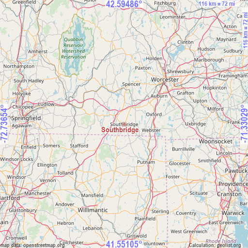
Southbridge GPS coordinates[2]
42° 4' 30.36" North, 72° 2' 0.276" West
| Map corner | latitude | longitude |
|---|---|---|
| Upper-left | 42.59486°, | -72.73654° |
| Center: | 42.0751°, | -72.03341° |
| Lower-right: | 41.55105°, | -71.33029° |
| Map W x H: | 116.1×116.1 km | = 72.1×72.1mi |
| max Lat: | 71.29058° ⇑23.7% North |
| Southbridge: | 42.0751° |
| min Lat: | ⇓76.3% South 19.06759° |
| min Long | Southbridge | max Long |
| -171.73463° | -72.03341° | -66.98998° |
| W 95.7%⇐ | ⇒4.3% E |
Elevation
Elevation of Southbridge is 152 m = 499 ft, and this is 142.8 m = 469 ft below average elevation for this country.
| Max E: |
3189 m = 10463 ft | 60.5% |
| Avg. | 294.8 m = 967 ft | |
| Southbridge | 152 m = 499 ft | |
Min E: |
-60 m = -197 ft | 39.5% |
See also: United States elevation on elevation.city.
Geographical zone
Southbridge is located in North temperate zone (between Tropic of Cancer and the Arctic Circle). Distance of this Northern Tropic circle is 2072.4 km =1287.7 mi to South.| Distance of | km | miles | from Southbridge |
|---|---|---|---|
| North Pole | 5328.7 | 3311.1 | to North |
| Arctic Circle | 2722.9 | 1691.9 | to North |
| Tropic Cancer | 2072.4 | 1287.7 | to South |
| Equator | 4678.3 | 2907 | to South |


Nearby cities:
15 places around Southbridge: (largest is in red/bold)
• Brimfield
14.8 km =9.2 mi,  291°
291°
• Brookfield
16.5 km =10.3 mi,  339°
339°
• Charlton
8.5 km =5.3 mi,  37°
37°
• Dudley
9.2 km =5.7 mi,  111°
111°
• East Brookfield
17 km =10.6 mi,  356°
356°
• Fiskdale
8 km =5 mi,  304°
304°
• Holland
10.3 km =6.4 mi,  263°
263°
• North Grosvenor Dale
14.9 km =9.3 mi,  131°
131°
• Oxford
14.7 km =9.1 mi,  71°
71°
• Quinebaug
9 km =5.6 mi, 129°
• South Woodstock
16.3 km =10.1 mi,  158°
158°
• Spencer
19.1 km =11.9 mi,  10°
10°
• Sturbridge
5.3 km =3.3 mi,  314°
314°
• Wales
15.6 km =9.7 mi,  267°
267°
• Webster
13 km =8.1 mi,  102°
102°
Sources, notices
• [Note1] Compared only with cities in United States existing in our database
• [Src1] Map data: © OpenStreetMap contributors (CC-BY-SA)
• [Src2] Other city data from geonames.org with taken over terms of usage.
• [Src3] Geographical zone / Annual Mean Temperature by Robert A. Rohde @ Wikipedia
