Quinebaug geodata
Quinebaug (Connecticut) is a populated place; located in United States in America/New_York (GMT-4) time zone. With population of 1,133 people, there are 15480 cities with bigger population in this country. Compared to other cities in United States, 75.9% of cities are located further ↓South; 95.8% of cities are located further ←West and 66.9% of cities have higher elevation than Quinebaug. Note1


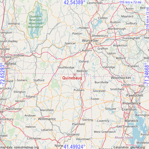
Quinebaug GPS coordinates[2]
42° 1' 25.356" North, 71° 56' 59.28" West
| Map corner | latitude | longitude |
|---|---|---|
| Upper-left | 42.54389°, | -72.65293° |
| Center: | 42.02371°, | -71.9498° |
| Lower-right: | 41.49924°, | -71.24668° |
| Map W x H: | 116.2×116.2 km | = 72.2×72.2mi |
| max Lat: | 71.29058° ⇑24.1% North |
| Quinebaug: | 42.02371° |
| min Lat: | ⇓75.9% South 19.06759° |
| min Long | Quinebaug | max Long |
| -171.73463° | -71.9498° | -66.98998° |
| W 95.8%⇐ | ⇒4.2% E |
Elevation
Elevation of Quinebaug is 118 m = 387 ft, and this is 176.8 m = 580 ft below average elevation for this country.
| Max E: |
3189 m = 10463 ft | 66.9% |
| Avg. | 294.8 m = 967 ft | |
| Quinebaug | 118 m = 387 ft | |
Min E: |
-60 m = -197 ft | 33.1% |
See also: United States elevation on elevation.city.
Geographical zone
Quinebaug is located in North temperate zone (between Tropic of Cancer and the Arctic Circle). Distance of this Northern Tropic circle is 2066.7 km =1284.2 mi to South.| Distance of | km | miles | from Quinebaug |
|---|---|---|---|
| North Pole | 5334.5 | 3314.7 | to North |
| Arctic Circle | 2728.6 | 1695.5 | to North |
| Tropic Cancer | 2066.7 | 1284.2 | to South |
| Equator | 4672.6 | 2903.4 | to South |


Nearby cities:
15 places around Quinebaug: (largest is in red/bold)
• Charlton
12.6 km =7.8 mi,  352°
352°
• Douglas
17.7 km =11 mi,  78°
78°
• Dudley
2.9 km =1.8 mi,  34°
34°
• East Douglas
20.3 km =12.6 mi,  74°
74°
• Fiskdale
17 km =10.6 mi,  307°
307°
• Holland
17.7 km =11 mi,  284°
284°
• North Grosvenor Dale
6 km =3.7 mi,  135°
135°
• Oxford
12.5 km =7.8 mi, 34°
• Putnam
12.5 km =7.8 mi,  164°
164°
• South Woodstock
9.5 km =5.9 mi,  184°
184°
• Southbridge
9 km =5.6 mi, 309°
• Sturbridge
14.2 km =8.8 mi, 311°
• Sutton
20.9 km =13 mi,  47°
47°
• Thompson
10.2 km =6.3 mi, 135°
• Webster
6.5 km =4 mi,  62°
62°
Sources, notices
• [Note1] Compared only with cities in United States existing in our database
• [Src1] Map data: © OpenStreetMap contributors (CC-BY-SA)
• [Src2] Other city data from geonames.org with taken over terms of usage.
• [Src3] Geographical zone / Annual Mean Temperature by Robert A. Rohde @ Wikipedia
