Worcester geodata
Worcester (Massachusetts) is a seat of a second-order administrative division; located in United States in America/New_York (GMT-4) time zone. With population of 184,815 people, there are 143 cities with bigger population in this country. Compared to other cities in United States, 77.9% of cities are located further ↓South; 96% of cities are located further ←West and 58.2% of cities have higher elevation than Worcester. Note1
Administrative division(s):
- Level 1: Massachusetts
- Level 2: Worcester County
- Level 3: City of Worcester


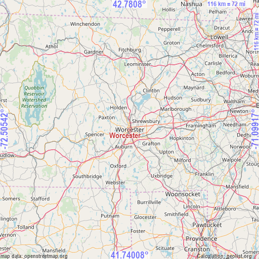
Worcester GPS coordinates[2]
42° 15' 45.324" North, 71° 48' 8.244" West
| Map corner | latitude | longitude |
|---|---|---|
| Upper-left | 42.7808°, | -72.50542° |
| Center: | 42.26259°, | -71.80229° |
| Lower-right: | 41.74008°, | -71.09917° |
| Map W x H: | 115.7×115.7 km | = 71.9×71.9mi |
| max Lat: | 71.29058° ⇑22.1% North |
| Worcester: | 42.26259° |
| min Lat: | ⇓77.9% South 19.06759° |
| min Long | Worcester | max Long |
| -171.73463° | -71.80229° | -66.98998° |
| W 96%⇐ | ⇒4% E |
Elevation
Elevation of Worcester is 164 m = 538 ft, and this is 130.8 m = 429 ft below average elevation for this country.
| Max E: |
3189 m = 10463 ft | 58.2% |
| Avg. | 294.8 m = 967 ft | |
| Worcester | 164 m = 538 ft | |
Min E: |
-60 m = -197 ft | 41.8% |
See also: Worcester elevation on elevation.city.
Geographical zone
Worcester is located in North temperate zone (between Tropic of Cancer and the Arctic Circle). Distance of this Northern Tropic circle is 2093.2 km =1300.7 mi to South.| Distance of | km | miles | from Worcester |
|---|---|---|---|
| North Pole | 5307.9 | 3298.2 | to North |
| Arctic Circle | 2702 | 1678.9 | to North |
| Tropic Cancer | 2093.2 | 1300.7 | to South |
| Equator | 4699.2 | 2919.9 | to South |


Nearby cities:
15 places around Worcester: (largest is in red/bold)
• Auburn
8 km =5 mi,  199°
199°
• Boylston
16.5 km =10.3 mi,  29°
29°
• Grafton
11.4 km =7.1 mi,  122°
122°
• Hamilton Worcester
2.9 km =1.8 mi,  103°
103°
• Holden
11.1 km =6.9 mi,  333°
333°
• Leicester
8.9 km =5.5 mi,  258°
258°
• Millbury
8.4 km =5.2 mi,  155°
155°
• Northborough
14.7 km =9.1 mi,  64°
64°
• Paxton
11.7 km =7.3 mi,  297°
297°
• Shrewsbury
8.2 km =5.1 mi, 63°
• Spencer
15.8 km =9.8 mi, 262°
• Sunderland
3.2 km =2 mi,  128°
128°
• Sutton
12.9 km =8 mi,  165°
165°
• West Boylston
11.7 km =7.3 mi,  6°
6°
• Westborough
15.3 km =9.5 mi,  87°
87°
Sources, notices
• [Note1] Compared only with cities in United States existing in our database
• [Src1] Map data: © OpenStreetMap contributors (CC-BY-SA)
• [Src2] Other city data from geonames.org with taken over terms of usage.
• [Src3] Geographical zone / Annual Mean Temperature by Robert A. Rohde @ Wikipedia
