Winthrop geodata
Winthrop (Maine) is a populated place; located in United States in America/New_York (GMT-4) time zone. With population of 2,650 people, there are 10286 cities with bigger population in this country. Compared to other cities in United States, 89.7% of cities are located further ↓South; 98.9% of cities are located further ←West and 75.1% of cities have higher elevation than Winthrop. Note1


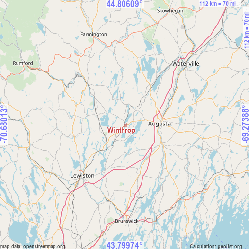
Winthrop GPS coordinates[2]
44° 18' 18.252" North, 69° 58' 37.2" West
| Map corner | latitude | longitude |
|---|---|---|
| Upper-left | 44.80609°, | -70.68013° |
| Center: | 44.30507°, | -69.977° |
| Lower-right: | 43.79974°, | -69.27388° |
| Map W x H: | 111.9×111.9 km | = 69.5×69.5mi |
| max Lat: | 71.29058° ⇑10.3% North |
| Winthrop: | 44.30507° |
| min Lat: | ⇓89.7% South 19.06759° |
| min Long | Winthrop | max Long |
| -171.73463° | -69.977° | -66.98998° |
| W 98.9%⇐ | ⇒1.1% E |
Elevation
Elevation of Winthrop is 71 m = 233 ft, and this is 223.8 m = 734 ft below average elevation for this country.
| Max E: |
3189 m = 10463 ft | 75.1% |
| Avg. | 294.8 m = 967 ft | |
| Winthrop | 71 m = 233 ft | |
Min E: |
-60 m = -197 ft | 24.9% |
See also: United States elevation on elevation.city.
Geographical zone
Winthrop is located in North temperate zone (between Tropic of Cancer and the Arctic Circle). Distance of this Northern Tropic circle is 2320.3 km =1441.8 mi to South.| Distance of | km | miles | from Winthrop |
|---|---|---|---|
| North Pole | 5080.8 | 3157.1 | to North |
| Arctic Circle | 2474.9 | 1537.8 | to North |
| Tropic Cancer | 2320.3 | 1441.8 | to South |
| Equator | 4926.3 | 3061.1 | to South |


Nearby cities:
15 places around Winthrop: (largest is in red/bold)
• Augusta
15.7 km =9.8 mi,  87°
87°
• Belgrade
19.5 km =12.1 mi,  35°
35°
• Chelsea
21.6 km =13.4 mi,  106°
106°
• Farmingdale
17.7 km =11 mi, 112°
• Fayette
12.4 km =7.7 mi,  338°
338°
• Gardiner
18.1 km =11.2 mi,  117°
117°
• Greene
18.3 km =11.4 mi,  225°
225°
• Hallowell
15 km =9.3 mi,  98°
98°
• Leeds
11.3 km =7 mi,  269°
269°
• Manchester
9.5 km =5.9 mi,  76°
76°
• Monmouth
8.7 km =5.4 mi,  212°
212°
• Pittston
19.9 km =12.4 mi, 117°
• Randolph
18.7 km =11.6 mi, 116°
• Readfield
9.2 km =5.7 mi,  5°
5°
• Wayne
8.6 km =5.3 mi,  304°
304°
Sources, notices
• [Note1] Compared only with cities in United States existing in our database
• [Src1] Map data: © OpenStreetMap contributors (CC-BY-SA)
• [Src2] Other city data from geonames.org with taken over terms of usage.
• [Src3] Geographical zone / Annual Mean Temperature by Robert A. Rohde @ Wikipedia
