Cedar Springs geodata
Cedar Springs (Michigan) is a populated place; located in United States in America/Detroit (GMT-4) time zone. With population of 3,624 people, there are 8692 cities with bigger population in this country. Compared to other cities in United States, 85% of cities are located further ↓South; 54.5% of cities are located further ←West and 64.3% of cities have lower elevation than Cedar Springs. Note1


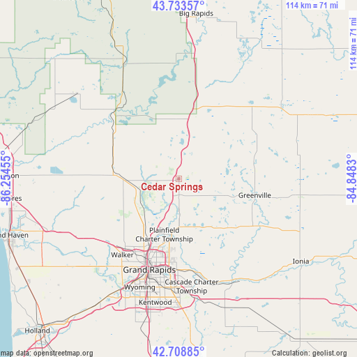
Cedar Springs GPS coordinates[2]
43° 13' 24.096" North, 85° 33' 5.112" West
| Map corner | latitude | longitude |
|---|---|---|
| Upper-left | 43.73357°, | -86.25455° |
| Center: | 43.22336°, | -85.55142° |
| Lower-right: | 42.70885°, | -84.8483° |
| Map W x H: | 113.9×113.9 km | = 70.8×70.8mi |
| max Lat: | 71.29058° ⇑15% North |
| Cedar Springs: | 43.22336° |
| min Lat: | ⇓85% South 19.06759° |
| min Long | Cedar Springs | max Long |
| -171.73463° | -85.55142° | -66.98998° |
| W 54.5%⇐ | ⇒45.5% E |
Elevation
Elevation of Cedar Springs is 259 m = 850 ft, and this is 35.8 m = 117 ft below average elevation for this country.
| Max E: |
3189 m = 10463 ft | 35.7% |
| Avg. | 294.8 m = 967 ft | |
| Cedar Springs | 259 m = 850 ft | |
Min E: |
-60 m = -197 ft | 64.3% |
See also: United States elevation on elevation.city.
Geographical zone
Cedar Springs is located in North temperate zone (between Tropic of Cancer and the Arctic Circle). Distance of this Northern Tropic circle is 2200.1 km =1367.1 mi to South.| Distance of | km | miles | from Cedar Springs |
|---|---|---|---|
| North Pole | 5201.1 | 3231.8 | to North |
| Arctic Circle | 2595.2 | 1612.6 | to North |
| Tropic Cancer | 2200.1 | 1367.1 | to South |
| Equator | 4806 | 2986.3 | to South |


Nearby cities:
15 places around Cedar Springs: (largest is in red/bold)
• Belding
29.6 km =18.4 mi,  118°
118°
• Comstock Park
22.7 km =14.1 mi,  205°
205°
• Forest Hills
29.8 km =18.5 mi,  170°
170°
• Grand Rapids
30.4 km =18.9 mi,  198°
198°
• Grant
24.5 km =15.2 mi,  300°
300°
• Greenville
24.7 km =15.3 mi,  101°
101°
• Howard City
20.3 km =12.6 mi,  19°
19°
• Kent City
16.2 km =10.1 mi,  268°
268°
• Newaygo
29.7 km =18.5 mi,  317°
317°
• Northview
20.2 km =12.6 mi,  191°
191°
• Ravenna
31.5 km =19.6 mi,  263°
263°
• Rockford
11.5 km =7.1 mi,  183°
183°
• Sand Lake
8.1 km =5 mi, 19°
• Sparta
14.6 km =9.1 mi,  241°
241°
• Walker
30.3 km =18.8 mi,  215°
215°
Sources, notices
• [Note1] Compared only with cities in United States existing in our database
• [Src1] Map data: © OpenStreetMap contributors (CC-BY-SA)
• [Src2] Other city data from geonames.org with taken over terms of usage.
• [Src3] Geographical zone / Annual Mean Temperature by Robert A. Rohde @ Wikipedia
