Greenville geodata
Greenville (Michigan) is a populated place; located in United States in America/Detroit (GMT-4) time zone. With population of 8,444 people, there are 5049 cities with bigger population in this country. Compared to other cities in United States, 84.6% of cities are located further ↓South; 55.2% of cities are located further ←West and 64.1% of cities have lower elevation than Greenville. Note1


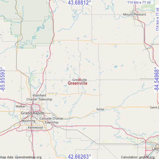
Greenville GPS coordinates[2]
43° 10' 39.108" North, 85° 15' 10.08" West
| Map corner | latitude | longitude |
|---|---|---|
| Upper-left | 43.68812°, | -85.95593° |
| Center: | 43.17753°, | -85.2528° |
| Lower-right: | 42.66263°, | -84.54968° |
| Map W x H: | 114×114 km | = 70.8×70.8mi |
| max Lat: | 71.29058° ⇑15.4% North |
| Greenville: | 43.17753° |
| min Lat: | ⇓84.6% South 19.06759° |
| min Long | Greenville | max Long |
| -171.73463° | -85.2528° | -66.98998° |
| W 55.2%⇐ | ⇒44.8% E |
Elevation
Elevation of Greenville is 258 m = 846 ft, and this is 36.8 m = 121 ft below average elevation for this country.
| Max E: |
3189 m = 10463 ft | 35.9% |
| Avg. | 294.8 m = 967 ft | |
| Greenville | 258 m = 846 ft | |
Min E: |
-60 m = -197 ft | 64.1% |
See also: United States elevation on elevation.city.
Geographical zone
Greenville is located in North temperate zone (between Tropic of Cancer and the Arctic Circle). Distance of this Northern Tropic circle is 2195 km =1363.9 mi to South.| Distance of | km | miles | from Greenville |
|---|---|---|---|
| North Pole | 5206.2 | 3235 | to North |
| Arctic Circle | 2600.3 | 1615.8 | to North |
| Tropic Cancer | 2195 | 1363.9 | to South |
| Equator | 4800.9 | 2983.1 | to South |


Nearby cities:
15 places around Greenville: (largest is in red/bold)
• Belding
9.1 km =5.7 mi,  167°
167°
• Cedar Springs
24.7 km =15.3 mi,  281°
281°
• Edmore
30.9 km =19.2 mi,  34°
34°
• Forest Hills
31 km =19.3 mi,  218°
218°
• Howard City
29.8 km =18.5 mi,  324°
324°
• Ionia
25.8 km =16 mi,  145°
145°
• Lakeview
29.9 km =18.6 mi,  356°
356°
• Lowell
28.1 km =17.5 mi,  194°
194°
• Muir
32.3 km =20.1 mi,  128°
128°
• Northview
31.8 km =19.8 mi,  242°
242°
• Rockford
25.7 km =16 mi,  255°
255°
• Sand Lake
25 km =15.5 mi,  300°
300°
• Saranac
27.8 km =17.3 mi, 173°
• Sheridan
15 km =9.3 mi,  75°
75°
• Stanton
18.9 km =11.7 mi,  47°
47°
Sources, notices
• [Note1] Compared only with cities in United States existing in our database
• [Src1] Map data: © OpenStreetMap contributors (CC-BY-SA)
• [Src2] Other city data from geonames.org with taken over terms of usage.
• [Src3] Geographical zone / Annual Mean Temperature by Robert A. Rohde @ Wikipedia
