Indian River geodata
Indian River (Michigan) is a populated place; located in United States in America/Detroit (GMT-4) time zone. With population of 1,959 people, there are 12058 cities with bigger population in this country. Compared to other cities in United States, 93.8% of cities are located further ↓South; 56.9% of cities are located further ←West and 53.6% of cities have higher elevation than Indian River. Note1
Administrative division(s):
- Level 1: Michigan
- Level 2: Cheboygan County
- Level 3: Township of Tuscarora


Indian River GPS coordinates[2]
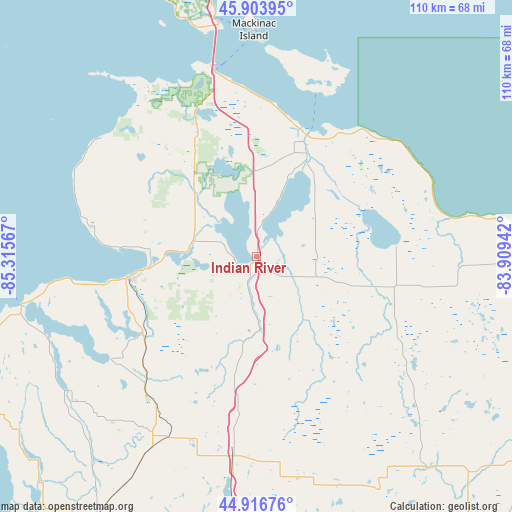
45° 24' 45.036" North, 84° 36' 45.144" West
| Map corner | latitude | longitude |
|---|---|---|
| Upper-left | 45.90395°, | -85.31567° |
| Center: | 45.41251°, | -84.61254° |
| Lower-right: | 44.91676°, | -83.90942° |
| Map W x H: | 109.8×109.8 km | = 68.2×68.2mi |
| max Lat: | 71.29058° ⇑6.2% North |
| Indian River: | 45.41251° |
| min Lat: | ⇓93.8% South 19.06759° |
| min Long | Indian River | max Long |
| -171.73463° | -84.61254° | -66.98998° |
| W 56.9%⇐ | ⇒43.1% E |
Elevation
Elevation of Indian River is 185 m = 607 ft, and this is 109.8 m = 360 ft below average elevation for this country.
| Max E: |
3189 m = 10463 ft | 53.6% |
| Avg. | 294.8 m = 967 ft | |
| Indian River | 185 m = 607 ft | |
Min E: |
-60 m = -197 ft | 46.4% |
See also: United States elevation on elevation.city.
Geographical zone
Indian River is located in North temperate zone (between Tropic of Cancer and the Arctic Circle). Distance of this North polar circle is 2351.8 km =1461.3 mi to North.| Distance of | km | miles | from Indian River |
|---|---|---|---|
| North Pole | 4957.7 | 3080.6 | to North |
| Arctic Circle | 2351.8 | 1461.3 | to North |
| Tropic Cancer | 2443.5 | 1518.3 | to South |
| Equator | 5049.4 | 3137.6 | to South |


Nearby cities:
15 places around Indian River: (largest is in red/bold)
• Alanson
14 km =8.7 mi,  284°
284°
• Bay Harbor
37.1 km =23.1 mi,  261°
261°
• Bay Shore
38.3 km =23.8 mi, 260°
• Boyne City
38.2 km =23.7 mi,  235°
235°
• Cheboygan
28.2 km =17.5 mi,  22°
22°
• East Jordan
49 km =30.4 mi,  234°
234°
• Gaylord
43.1 km =26.8 mi,  186°
186°
• Harbor Springs
29.7 km =18.5 mi,  274°
274°
• Horton Bay
39.1 km =24.3 mi,  248°
248°
• Mackinaw City
41.6 km =25.8 mi,  347°
347°
• Onaway
31 km =19.3 mi,  101°
101°
• Pellston
20.6 km =12.8 mi,  319°
319°
• Petoskey
27.1 km =16.8 mi, 260°
• Saint Ignace
51.2 km =31.8 mi, 349°
• Vanderbilt
30.2 km =18.8 mi, 187°
Sources, notices
• [Note1] Compared only with cities in United States existing in our database
• [Src1] Map data: © OpenStreetMap contributors (CC-BY-SA)
• [Src2] Other city data from geonames.org with taken over terms of usage.
• [Src3] Geographical zone / Annual Mean Temperature by Robert A. Rohde @ Wikipedia
