Lakewood Club geodata
Lakewood Club (Michigan) is a populated place; located in United States in America/Detroit (GMT-4) time zone. With population of 1,288 people, there are 14649 cities with bigger population in this country. Compared to other cities in United States, 85.7% of cities are located further ↓South; 52.2% of cities are located further ←West and 54.2% of cities have lower elevation than Lakewood Club. Note1


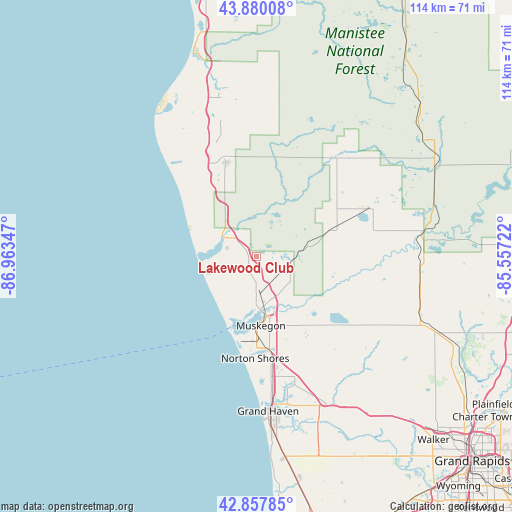
Lakewood Club GPS coordinates[2]
43° 22' 16.032" North, 86° 15' 37.224" West
| Map corner | latitude | longitude |
|---|---|---|
| Upper-left | 43.88008°, | -86.96347° |
| Center: | 43.37112°, | -86.26034° |
| Lower-right: | 42.85785°, | -85.55722° |
| Map W x H: | 113.7×113.7 km | = 70.6×70.6mi |
| max Lat: | 71.29058° ⇑14.3% North |
| Lakewood Club: | 43.37112° |
| min Lat: | ⇓85.7% South 19.06759° |
| min Long | Lakewood Club | max Long |
| -171.73463° | -86.26034° | -66.98998° |
| W 52.2%⇐ | ⇒47.8% E |
Elevation
Elevation of Lakewood Club is 215 m = 705 ft, and this is 79.8 m = 262 ft below average elevation for this country.
| Max E: |
3189 m = 10463 ft | 45.8% |
| Avg. | 294.8 m = 967 ft | |
| Lakewood Club | 215 m = 705 ft | |
Min E: |
-60 m = -197 ft | 54.2% |
See also: United States elevation on elevation.city.
Geographical zone
Lakewood Club is located in North temperate zone (between Tropic of Cancer and the Arctic Circle). Distance of this Northern Tropic circle is 2216.5 km =1377.3 mi to South.| Distance of | km | miles | from Lakewood Club |
|---|---|---|---|
| North Pole | 5184.6 | 3221.6 | to North |
| Arctic Circle | 2578.8 | 1602.4 | to North |
| Tropic Cancer | 2216.5 | 1377.3 | to South |
| Equator | 4822.4 | 2996.5 | to South |


Nearby cities:
15 places around Lakewood Club: (largest is in red/bold)
• Ferrysburg
32 km =19.9 mi,  174°
174°
• Fremont
27.9 km =17.3 mi,  67°
67°
• Fruitport
27.9 km =17.3 mi,  162°
162°
• Hesperia
28.3 km =17.6 mi,  39°
39°
• Montague
9.3 km =5.8 mi,  302°
302°
• Muskegon
15.3 km =9.5 mi,  176°
176°
• Muskegon Heights
19 km =11.8 mi, 174°
• North Muskegon
12.8 km =8 mi, 182°
• Norton Shores
22.5 km =14 mi, 180°
• Ravenna
33.1 km =20.6 mi,  127°
127°
• Roosevelt Park
19.5 km =12.1 mi, 182°
• Shelby
27.7 km =17.2 mi,  342°
342°
• Twin Lake
7.8 km =4.8 mi,  96°
96°
• Whitehall
8.3 km =5.2 mi, 301°
• Wolf Lake
17.8 km =11.1 mi,  136°
136°
Sources, notices
• [Note1] Compared only with cities in United States existing in our database
• [Src1] Map data: © OpenStreetMap contributors (CC-BY-SA)
• [Src2] Other city data from geonames.org with taken over terms of usage.
• [Src3] Geographical zone / Annual Mean Temperature by Robert A. Rohde @ Wikipedia
