Lathrup Village geodata
Lathrup Village (Michigan) is a populated place; located in United States in America/Detroit (GMT-4) time zone. With population of 4,135 people, there are 8060 cities with bigger population in this country. Compared to other cities in United States, 79.8% of cities are located further ↓South; 61.4% of cities are located further ←West and 54.7% of cities have lower elevation than Lathrup Village. Note1
Administrative division(s):
- Level 1: Michigan
- Level 2: Oakland County
- Level 3: City of Lathrup Village


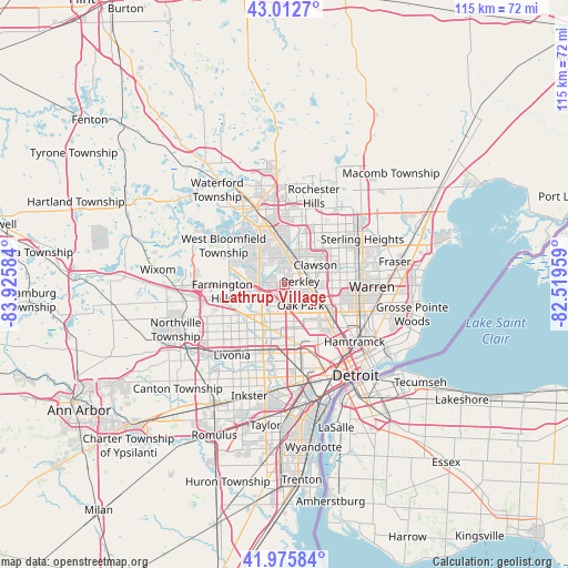
Lathrup Village GPS coordinates[2]
42° 29' 47.112" North, 83° 13' 21.756" West
| Map corner | latitude | longitude |
|---|---|---|
| Upper-left | 43.0127°, | -83.92584° |
| Center: | 42.49642°, | -83.22271° |
| Lower-right: | 41.97584°, | -82.51959° |
| Map W x H: | 115.3×115.3 km | = 71.6×71.6mi |
| max Lat: | 71.29058° ⇑20.2% North |
| Lathrup Village: | 42.49642° |
| min Lat: | ⇓79.8% South 19.06759° |
| min Long | Lathrup Village | max Long |
| -171.73463° | -83.22271° | -66.98998° |
| W 61.4%⇐ | ⇒38.6% E |
Elevation
Elevation of Lathrup Village is 217 m = 712 ft, and this is 77.8 m = 255 ft below average elevation for this country.
| Max E: |
3189 m = 10463 ft | 45.3% |
| Avg. | 294.8 m = 967 ft | |
| Lathrup Village | 217 m = 712 ft | |
Min E: |
-60 m = -197 ft | 54.7% |
See also: United States elevation on elevation.city.
Geographical zone
Lathrup Village is located in North temperate zone (between Tropic of Cancer and the Arctic Circle). Distance of this Northern Tropic circle is 2119.2 km =1316.8 mi to South.| Distance of | km | miles | from Lathrup Village |
|---|---|---|---|
| North Pole | 5281.9 | 3282 | to North |
| Arctic Circle | 2676 | 1662.8 | to North |
| Tropic Cancer | 2119.2 | 1316.8 | to South |
| Equator | 4725.2 | 2936.1 | to South |


Nearby cities:
15 places around Lathrup Village: (largest is in red/bold)
• Berkley
3.3 km =2.1 mi,  76°
76°
• Beverly Hills
3.1 km =1.9 mi,  359°
359°
• Bingham Farms
4.7 km =2.9 mi,  297°
297°
• Birmingham
5.7 km =3.5 mi,  9°
9°
• Bloomfield Hills
9.9 km =6.2 mi,  349°
349°
• Clawson
7.5 km =4.7 mi,  56°
56°
• Ferndale
8.2 km =5.1 mi,  118°
118°
• Franklin
7.4 km =4.6 mi,  292°
292°
• Hazel Park
10.4 km =6.5 mi,  111°
111°
• Huntington Woods
4.9 km =3 mi, 111°
• Madison Heights
9.7 km =6 mi,  96°
96°
• Oak Park
5.3 km =3.3 mi,  141°
141°
• Pleasant Ridge
7.2 km =4.5 mi, 113°
• Royal Oak
6.4 km =4 mi, 96°
• Southfield
2.6 km =1.6 mi,  178°
178°
Sources, notices
• [Note1] Compared only with cities in United States existing in our database
• [Src1] Map data: © OpenStreetMap contributors (CC-BY-SA)
• [Src2] Other city data from geonames.org with taken over terms of usage.
• [Src3] Geographical zone / Annual Mean Temperature by Robert A. Rohde @ Wikipedia
