Chisago City geodata
Chisago City (Minnesota) is a populated place; located in United States in America/Chicago (GMT-5) time zone. With population of 4,932 people, there are 7252 cities with bigger population in this country. Compared to other cities in United States, 93.6% of cities are located further ↓South; 66% of cities are located further →East and 68.9% of cities have lower elevation than Chisago City. Note1
Administrative division(s):
- Level 1: Minnesota
- Level 2: Chisago County
- Level 3: City of Chisago City


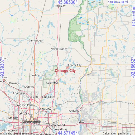
Chisago City GPS coordinates[2]
45° 22' 24.888" North, 92° 53' 23.784" West
| Map corner | latitude | longitude |
|---|---|---|
| Upper-left | 45.86536°, | -93.59307° |
| Center: | 45.37358°, | -92.88994° |
| Lower-right: | 44.87749°, | -92.18682° |
| Map W x H: | 109.8×109.8 km | = 68.2×68.2mi |
| max Lat: | 71.29058° ⇑6.4% North |
| Chisago City: | 45.37358° |
| min Lat: | ⇓93.6% South 19.06759° |
| min Long | Chisago City | max Long |
| -171.73463° | -92.88994° | -66.98998° |
| W 34%⇐ | ⇒66% E |
Elevation
Elevation of Chisago City is 280 m = 919 ft, and this is 14.8 m = 49 ft below average elevation for this country.
| Max E: |
3189 m = 10463 ft | 31.1% |
| Avg. | 294.8 m = 967 ft | |
| Chisago City | 280 m = 919 ft | |
Min E: |
-60 m = -197 ft | 68.9% |
See also: United States elevation on elevation.city.
Geographical zone
Chisago City is located in North temperate zone (between Tropic of Cancer and the Arctic Circle). Distance of this North polar circle is 2356.1 km =1464 mi to North.| Distance of | km | miles | from Chisago City |
|---|---|---|---|
| North Pole | 4962 | 3083.2 | to North |
| Arctic Circle | 2356.1 | 1464 | to North |
| Tropic Cancer | 2439.2 | 1515.6 | to South |
| Equator | 5045.1 | 3134.9 | to South |


Nearby cities:
15 places around Chisago City: (largest is in red/bold)
• Branch
13.6 km =8.5 mi,  335°
335°
• Center City
6.2 km =3.9 mi,  68°
68°
• Columbus
17.4 km =10.8 mi,  226°
226°
• Dresser
20.1 km =12.5 mi,  95°
95°
• Forest Lake
12.9 km =8 mi,  215°
215°
• Lindstrom
3.7 km =2.3 mi,  61°
61°
• Martin Lake
16 km =9.9 mi,  272°
272°
• North Branch
16.9 km =10.5 mi, 335°
• Osceola
15.6 km =9.7 mi,  112°
112°
• Saint Croix Falls
20 km =12.4 mi,  78°
78°
• Scandia
14.9 km =9.3 mi,  153°
153°
• Shafer
11.2 km =7 mi, 82°
• Stacy
8.1 km =5 mi,  289°
289°
• Taylors Falls
18.8 km =11.7 mi, 80°
• Wyoming
9.3 km =5.8 mi,  243°
243°
Sources, notices
• [Note1] Compared only with cities in United States existing in our database
• [Src1] Map data: © OpenStreetMap contributors (CC-BY-SA)
• [Src2] Other city data from geonames.org with taken over terms of usage.
• [Src3] Geographical zone / Annual Mean Temperature by Robert A. Rohde @ Wikipedia
