Mahtomedi geodata
Mahtomedi (Minnesota) is a populated place; located in United States in America/Chicago (GMT-5) time zone. With population of 8,116 people, there are 5229 cities with bigger population in this country. Compared to other cities in United States, 92.8% of cities are located further ↓South; 66.1% of cities are located further →East and 73.6% of cities have lower elevation than Mahtomedi. Note1
Administrative division(s):
- Level 1: Minnesota
- Level 2: Washington County
- Level 3: City of Mahtomedi


Mahtomedi GPS coordinates[2]
45° 4' 10.884" North, 92° 57' 5.76" West
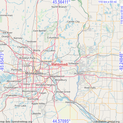
| Map corner | latitude | longitude |
|---|---|---|
| Upper-left | 45.56411°, | -93.65473° |
| Center: | 45.06969°, | -92.9516° |
| Lower-right: | 44.57095°, | -92.24848° |
| Map W x H: | 110.4×110.4 km | = 68.6×68.6mi |
| max Lat: | 71.29058° ⇑7.2% North |
| Mahtomedi: | 45.06969° |
| min Lat: | ⇓92.8% South 19.06759° |
| min Long | Mahtomedi | max Long |
| -171.73463° | -92.9516° | -66.98998° |
| W 33.9%⇐ | ⇒66.1% E |
Elevation
Elevation of Mahtomedi is 305 m = 1001 ft, and this is 10.2 m = 33 ft above average elevation for this country.
| Max E: |
3189 m = 10463 ft | 26.4% |
| Mahtomedi | 305 m 1001 ft | |
| Avg. | 294.8 m = 967 ft | |
Min E: |
-60 m = -197 ft | 73.6% |
See also: United States elevation on elevation.city.
Geographical zone
Mahtomedi is located in North temperate zone (between Tropic of Cancer and the Arctic Circle). Distance of this North polar circle is 2389.9 km =1485 mi to North.| Distance of | km | miles | from Mahtomedi |
|---|---|---|---|
| North Pole | 4995.8 | 3104.2 | to North |
| Arctic Circle | 2389.9 | 1485 | to North |
| Tropic Cancer | 2405.4 | 1494.6 | to South |
| Equator | 5011.3 | 3113.9 | to South |


Nearby cities:
15 places around Mahtomedi: (largest is in red/bold)
• Birchwood
2.1 km =1.3 mi,  243°
243°
• Centerville
13.2 km =8.2 mi,  321°
321°
• Dellwood
2.8 km =1.7 mi, 324°
• Grant
3.6 km =2.2 mi,  63°
63°
• Hugo
10.6 km =6.6 mi,  341°
341°
• Lake Elmo
10 km =6.2 mi,  145°
145°
• Landfall
13.4 km =8.3 mi,  188°
188°
• Little Canada
11.7 km =7.3 mi,  246°
246°
• North Oaks
10.7 km =6.6 mi,  290°
290°
• North Saint Paul
7.1 km =4.4 mi,  206°
206°
• Oak Park Heights
13.2 km =8.2 mi,  108°
108°
• Oakdale
11.9 km =7.4 mi, 185°
• Stillwater
11.5 km =7.1 mi,  97°
97°
• Vadnais Heights
9.7 km =6 mi,  261°
261°
• White Bear Lake
4.9 km =3 mi, 290°
Sources, notices
• [Note1] Compared only with cities in United States existing in our database
• [Src1] Map data: © OpenStreetMap contributors (CC-BY-SA)
• [Src2] Other city data from geonames.org with taken over terms of usage.
• [Src3] Geographical zone / Annual Mean Temperature by Robert A. Rohde @ Wikipedia
