Bradley Gardens geodata
Bradley Gardens (New Jersey) is a populated place; located in United States in America/New_York (GMT-4) time zone. With population of 14,206 people, there are 3393 cities with bigger population in this country. Compared to other cities in United States, 59.5% of cities are located further ↓South; 88.1% of cities are located further ←West and 86.6% of cities have higher elevation than Bradley Gardens. Note1
Administrative division(s):
- Level 1: New Jersey
- Level 2: Somerset County
- Level 3: Township of Bridgewater


Bradley Gardens GPS coordinates[2]
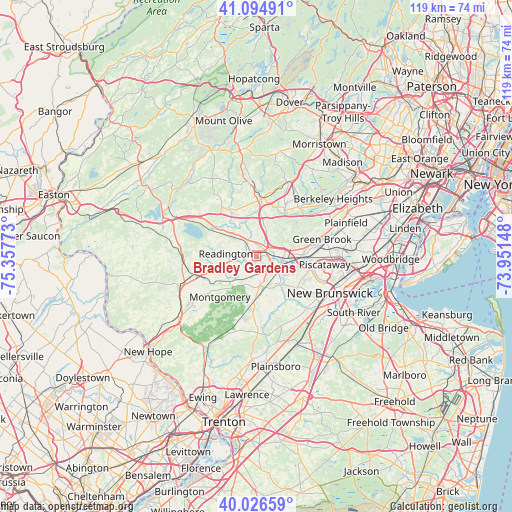
40° 33' 46.368" North, 74° 39' 16.56" West
| Map corner | latitude | longitude |
|---|---|---|
| Upper-left | 41.09491°, | -75.35773° |
| Center: | 40.56288°, | -74.6546° |
| Lower-right: | 40.02659°, | -73.95148° |
| Map W x H: | 118.8×118.8 km | = 73.8×73.8mi |
| max Lat: | 71.29058° ⇑40.5% North |
| Bradley Gardens: | 40.56288° |
| min Lat: | ⇓59.5% South 19.06759° |
| min Long | Bradley Gardens | max Long |
| -171.73463° | -74.6546° | -66.98998° |
| W 88.1%⇐ | ⇒11.9% E |
Elevation
Elevation of Bradley Gardens is 24 m = 79 ft, and this is 270.8 m = 888 ft below average elevation for this country.
| Max E: |
3189 m = 10463 ft | 86.6% |
| Avg. | 294.8 m = 967 ft | |
| Bradley Gardens | 24 m = 79 ft | |
Min E: |
-60 m = -197 ft | 13.4% |
See also: United States elevation on elevation.city.
Geographical zone
Bradley Gardens is located in North temperate zone (between Tropic of Cancer and the Arctic Circle). Distance of this Northern Tropic circle is 1904.3 km =1183.3 mi to South.| Distance of | km | miles | from Bradley Gardens |
|---|---|---|---|
| North Pole | 5496.9 | 3415.6 | to North |
| Arctic Circle | 2891 | 1796.4 | to North |
| Tropic Cancer | 1904.3 | 1183.3 | to South |
| Equator | 4510.2 | 2802.5 | to South |


Nearby cities:
15 places around Bradley Gardens: (largest is in red/bold)
• Blackwells Mills
12 km =7.5 mi,  144°
144°
• Bloomingdale
7.3 km =4.5 mi,  175°
175°
• Bound Brook
9.8 km =6.1 mi,  86°
86°
• Bridgewater
4.3 km =2.7 mi,  7°
7°
• East Millstone
9.3 km =5.8 mi, 137°
• Finderne
6.5 km =4 mi, 89°
• Franklin Center
10.2 km =6.3 mi,  110°
110°
• Green Knoll
5.5 km =3.4 mi,  40°
40°
• Manville
6.2 km =3.9 mi, 113°
• Martinsville
9.1 km =5.7 mi,  62°
62°
• Raritan
2 km =1.2 mi,  67°
67°
• Somerville
4 km =2.5 mi, 71°
• South Bound Brook
10.4 km =6.5 mi,  95°
95°
• Weston
6.2 km =3.9 mi,  119°
119°
• Whitehouse Station
11.4 km =7.1 mi,  300°
300°
Sources, notices
• [Note1] Compared only with cities in United States existing in our database
• [Src1] Map data: © OpenStreetMap contributors (CC-BY-SA)
• [Src2] Other city data from geonames.org with taken over terms of usage.
• [Src3] Geographical zone / Annual Mean Temperature by Robert A. Rohde @ Wikipedia
