Marlboro geodata
Marlboro (New Jersey) is a populated place; located in United States in America/New_York (GMT-4) time zone. With population of 40,191 people, there are 1205 cities with bigger population in this country. Compared to other cities in United States, 56.8% of cities are located further ↓South; 89.3% of cities are located further ←West and 77.5% of cities have higher elevation than Marlboro. Note1
Administrative division(s):
- Level 1: New Jersey
- Level 2: Monmouth County
- Level 3: Township of Marlboro


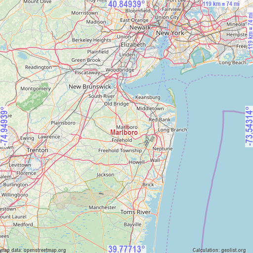
Marlboro GPS coordinates[2]
40° 18' 55.404" North, 74° 14' 46.536" West
| Map corner | latitude | longitude |
|---|---|---|
| Upper-left | 40.84939°, | -74.94939° |
| Center: | 40.31539°, | -74.24626° |
| Lower-right: | 39.77713°, | -73.54314° |
| Map W x H: | 119.2×119.2 km | = 74.1×74.1mi |
| max Lat: | 71.29058° ⇑43.2% North |
| Marlboro: | 40.31539° |
| min Lat: | ⇓56.8% South 19.06759° |
| min Long | Marlboro | max Long |
| -171.73463° | -74.24626° | -66.98998° |
| W 89.3%⇐ | ⇒10.7% E |
Elevation
Elevation of Marlboro is 58 m = 190 ft, and this is 236.8 m = 777 ft below average elevation for this country.
| Max E: |
3189 m = 10463 ft | 77.5% |
| Avg. | 294.8 m = 967 ft | |
| Marlboro | 58 m = 190 ft | |
Min E: |
-60 m = -197 ft | 22.5% |
See also: Marlboro elevation on elevation.city.
Geographical zone
Marlboro is located in North temperate zone (between Tropic of Cancer and the Arctic Circle). Distance of this Northern Tropic circle is 1876.7 km =1166.1 mi to South.| Distance of | km | miles | from Marlboro |
|---|---|---|---|
| North Pole | 5524.4 | 3432.7 | to North |
| Arctic Circle | 2918.5 | 1813.5 | to North |
| Tropic Cancer | 1876.7 | 1166.1 | to South |
| Equator | 4482.7 | 2785.4 | to South |


Nearby cities:
15 places around Marlboro: (largest is in red/bold)
• Brownville
10.3 km =6.4 mi,  336°
336°
• Cliffwood Beach
14.3 km =8.9 mi,  10°
10°
• East Freehold
3.9 km =2.4 mi,  186°
186°
• Englishtown
9.7 km =6 mi,  258°
258°
• Freehold
6.6 km =4.1 mi,  200°
200°
• Keyport
13.7 km =8.5 mi,  16°
16°
• Lincroft
10.8 km =6.7 mi,  80°
80°
• Matawan
11.1 km =6.9 mi, 7°
• Morganville
6.8 km =4.2 mi,  1°
1°
• Robertsville
4.9 km =3 mi,  314°
314°
• South Old Bridge
13.8 km =8.6 mi,  318°
318°
• Strathmore
9.4 km =5.8 mi, 17°
• Tinton Falls
12.4 km =7.7 mi,  95°
95°
• West Freehold
9.4 km =5.8 mi,  209°
209°
• Yorketown
7.8 km =4.8 mi, 263°
Sources, notices
• [Note1] Compared only with cities in United States existing in our database
• [Src1] Map data: © OpenStreetMap contributors (CC-BY-SA)
• [Src2] Other city data from geonames.org with taken over terms of usage.
• [Src3] Geographical zone / Annual Mean Temperature by Robert A. Rohde @ Wikipedia
