Brownville geodata
Brownville (New York) is a populated place; located in United States in America/New_York (GMT-4) time zone. With population of 1,156 people, there are 15353 cities with bigger population in this country. Compared to other cities in United States, 88.4% of cities are located further ↓South; 84.1% of cities are located further ←West and 68.9% of cities have higher elevation than Brownville. Note1


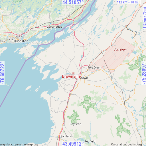
Brownville GPS coordinates[2]
44° 0' 25.2" North, 75° 59' 2.724" West
| Map corner | latitude | longitude |
|---|---|---|
| Upper-left | 44.51057°, | -76.68722° |
| Center: | 44.007°, | -75.98409° |
| Lower-right: | 43.49912°, | -75.28097° |
| Map W x H: | 112.5×112.5 km | = 69.9×69.9mi |
| max Lat: | 71.29058° ⇑11.6% North |
| Brownville: | 44.007° |
| min Lat: | ⇓88.4% South 19.06759° |
| min Long | Brownville | max Long |
| -171.73463° | -75.98409° | -66.98998° |
| W 84.1%⇐ | ⇒15.9% E |
Elevation
Elevation of Brownville is 107 m = 351 ft, and this is 187.8 m = 616 ft below average elevation for this country.
| Max E: |
3189 m = 10463 ft | 68.9% |
| Avg. | 294.8 m = 967 ft | |
| Brownville | 107 m = 351 ft | |
Min E: |
-60 m = -197 ft | 31.1% |
See also: United States elevation on elevation.city.
Geographical zone
Brownville is located in North temperate zone (between Tropic of Cancer and the Arctic Circle). Distance of this Northern Tropic circle is 2287.2 km =1421.2 mi to South.| Distance of | km | miles | from Brownville |
|---|---|---|---|
| North Pole | 5113.9 | 3177.6 | to North |
| Arctic Circle | 2508.1 | 1558.5 | to North |
| Tropic Cancer | 2287.2 | 1421.2 | to South |
| Equator | 4893.1 | 3040.4 | to South |


Nearby cities:
15 places around Brownville: (largest is in red/bold)
• Adams
22.2 km =13.8 mi,  188°
188°
• Adams Center
16.4 km =10.2 mi, 185°
• Black River
15.2 km =9.4 mi,  87°
87°
• Calcium
11.2 km =7 mi,  81°
81°
• Chaumont
13.5 km =8.4 mi,  299°
299°
• Clayton
27.1 km =16.8 mi,  342°
342°
• Depauville
16 km =9.9 mi, 336°
• Dexter
4.8 km =3 mi,  271°
271°
• Evans Mills
16.8 km =10.4 mi,  57°
57°
• Fort Drum
18.7 km =11.6 mi,  72°
72°
• Glen Park
1.6 km =1 mi,  114°
114°
• Great Bend
21.4 km =13.3 mi, 81°
• La Fargeville
20.9 km =13 mi,  3°
3°
• Sackets Harbor
12.7 km =7.9 mi,  237°
237°
• Watertown
6.9 km =4.3 mi,  121°
121°
Sources, notices
• [Note1] Compared only with cities in United States existing in our database
• [Src1] Map data: © OpenStreetMap contributors (CC-BY-SA)
• [Src2] Other city data from geonames.org with taken over terms of usage.
• [Src3] Geographical zone / Annual Mean Temperature by Robert A. Rohde @ Wikipedia
