Hempstead geodata
Hempstead (New York) is a populated place; located in United States in America/New_York (GMT-4) time zone. With population of 55,547 people, there are 826 cities with bigger population in this country. Compared to other cities in United States, 61.7% of cities are located further ↓South; 92.5% of cities are located further ←West and 87.8% of cities have higher elevation than Hempstead. Note1


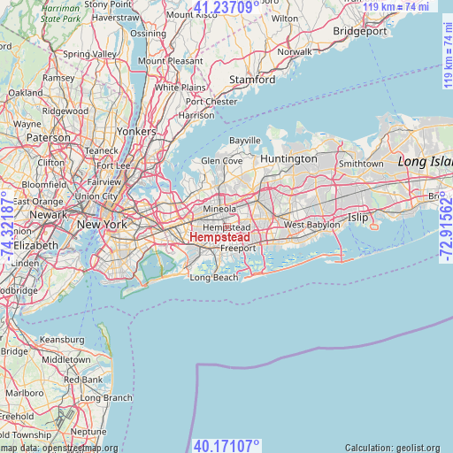
Hempstead GPS coordinates[2]
40° 42' 22.356" North, 73° 37' 7.464" West
| Map corner | latitude | longitude |
|---|---|---|
| Upper-left | 41.23709°, | -74.32187° |
| Center: | 40.70621°, | -73.61874° |
| Lower-right: | 40.17107°, | -72.91562° |
| Map W x H: | 118.5×118.5 km | = 73.6×73.6mi |
| max Lat: | 71.29058° ⇑38.3% North |
| Hempstead: | 40.70621° |
| min Lat: | ⇓61.7% South 19.06759° |
| min Long | Hempstead | max Long |
| -171.73463° | -73.61874° | -66.98998° |
| W 92.5%⇐ | ⇒7.5% E |
Elevation
Elevation of Hempstead is 21 m = 69 ft, and this is 273.8 m = 898 ft below average elevation for this country.
| Max E: |
3189 m = 10463 ft | 87.8% |
| Avg. | 294.8 m = 967 ft | |
| Hempstead | 21 m = 69 ft | |
Min E: |
-60 m = -197 ft | 12.2% |
See also: Hempstead elevation on elevation.city.
Geographical zone
Hempstead is located in North temperate zone (between Tropic of Cancer and the Arctic Circle). Distance of this Northern Tropic circle is 1920.2 km =1193.2 mi to South.| Distance of | km | miles | from Hempstead |
|---|---|---|---|
| North Pole | 5481 | 3405.7 | to North |
| Arctic Circle | 2875.1 | 1786.5 | to North |
| Tropic Cancer | 1920.2 | 1193.2 | to South |
| Equator | 4526.1 | 2812.4 | to South |


Nearby cities:
15 places around Hempstead: (largest is in red/bold)
• Baldwin
5.6 km =3.5 mi,  171°
171°
• Carle Place
5.2 km =3.2 mi,  7°
7°
• East Garden City
3.2 km =2 mi,  32°
32°
• East Meadow
5.1 km =3.2 mi,  80°
80°
• Franklin Square
4.8 km =3 mi,  271°
271°
• Garden City
2.6 km =1.6 mi,  330°
330°
• Garden City Park
5.3 km =3.3 mi,  316°
316°
• Garden City South
3.6 km =2.2 mi,  280°
280°
• Lakeview
3.7 km =2.3 mi,  230°
230°
• Mineola
5.1 km =3.2 mi,  338°
338°
• North Merrick
5 km =3.1 mi,  109°
109°
• Roosevelt
4 km =2.5 mi,  140°
140°
• South Hempstead
2.8 km =1.7 mi, 174°
• Uniondale
2.3 km =1.4 mi, 106°
• West Hempstead
2.7 km =1.7 mi, 266°
Sources, notices
• [Note1] Compared only with cities in United States existing in our database
• [Src1] Map data: © OpenStreetMap contributors (CC-BY-SA)
• [Src2] Other city data from geonames.org with taken over terms of usage.
• [Src3] Geographical zone / Annual Mean Temperature by Robert A. Rohde @ Wikipedia
