Bala-Cynwyd geodata
Bala-Cynwyd (Pennsylvania) is a populated place; located in United States in America/New_York (GMT-4) time zone. With population of 9,299 people, there are 4688 cities with bigger population in this country. Compared to other cities in United States, 53.6% of cities are located further ↓South; 86.6% of cities are located further ←West and 70.4% of cities have higher elevation than Bala-Cynwyd. Note1
Administrative division(s):
- Level 1: Pennsylvania
- Level 2: Montgomery County
- Level 3: Township of Lower Merion


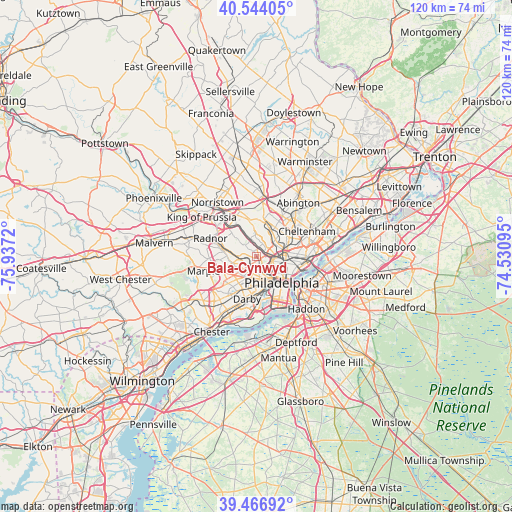
Bala-Cynwyd GPS coordinates[2]
40° 0' 27.396" North, 75° 14' 2.652" West
| Map corner | latitude | longitude |
|---|---|---|
| Upper-left | 40.54405°, | -75.9372° |
| Center: | 40.00761°, | -75.23407° |
| Lower-right: | 39.46692°, | -74.53095° |
| Map W x H: | 119.8×119.8 km | = 74.4×74.4mi |
| max Lat: | 71.29058° ⇑46.4% North |
| Bala-Cynwyd: | 40.00761° |
| min Lat: | ⇓53.6% South 19.06759° |
| min Long | Bala-Cynwyd | max Long |
| -171.73463° | -75.23407° | -66.98998° |
| W 86.6%⇐ | ⇒13.4% E |
Elevation
Elevation of Bala-Cynwyd is 98 m = 322 ft, and this is 196.8 m = 646 ft below average elevation for this country.
| Max E: |
3189 m = 10463 ft | 70.4% |
| Avg. | 294.8 m = 967 ft | |
| Bala-Cynwyd | 98 m = 322 ft | |
Min E: |
-60 m = -197 ft | 29.6% |
See also: United States elevation on elevation.city.
Geographical zone
Bala-Cynwyd is located in North temperate zone (between Tropic of Cancer and the Arctic Circle). Distance of this Northern Tropic circle is 1842.5 km =1144.9 mi to South.| Distance of | km | miles | from Bala-Cynwyd |
|---|---|---|---|
| North Pole | 5558.6 | 3454 | to North |
| Arctic Circle | 2952.7 | 1834.7 | to North |
| Tropic Cancer | 1842.5 | 1144.9 | to South |
| Equator | 4448.4 | 2764.1 | to South |


Nearby cities:
15 places around Bala-Cynwyd: (largest is in red/bold)
• Ardmore
4.4 km =2.7 mi,  268°
268°
• Bryn Mawr
6.2 km =3.9 mi,  282°
282°
• Center City
8.9 km =5.5 mi,  134°
134°
• Drexel Hill
8.4 km =5.2 mi,  216°
216°
• East Lansdowne
7.3 km =4.5 mi,  198°
198°
• Lafayette Hill
9.6 km =6 mi,  350°
350°
• Lansdowne
8.4 km =5.2 mi, 202°
• Millbourne
5.1 km =3.2 mi, 195°
• Narberth
2.2 km =1.4 mi, 272°
• Penn Wynne
4.3 km =2.7 mi,  235°
235°
• Philadelphia
8.6 km =5.3 mi,  135°
135°
• Tioga
5.6 km =3.5 mi,  88°
88°
• West Conshohocken
9.8 km =6.1 mi,  314°
314°
• Wyndmoor
9 km =5.6 mi,  24°
24°
• Yeadon
7.8 km =4.8 mi,  193°
193°
Sources, notices
• [Note1] Compared only with cities in United States existing in our database
• [Src1] Map data: © OpenStreetMap contributors (CC-BY-SA)
• [Src2] Other city data from geonames.org with taken over terms of usage.
• [Src3] Geographical zone / Annual Mean Temperature by Robert A. Rohde @ Wikipedia
