Benton geodata
Benton (Pennsylvania) is a populated place; located in United States in America/New_York (GMT-4) time zone. With population of 831 people, there are 17517 cities with bigger population in this country. Compared to other cities in United States, 67.8% of cities are located further ↓South; 83% of cities are located further ←West and 59% of cities have lower elevation than Benton. Note1
Administrative division(s):
- Level 1: Pennsylvania
- Level 2: Columbia County
- Level 3: Borough of Benton


Benton GPS coordinates[2]
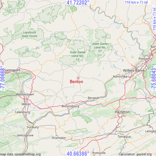
41° 11' 42.288" North, 76° 23' 0.78" West
| Map corner | latitude | longitude |
|---|---|---|
| Upper-left | 41.72202°, | -77.08668° |
| Center: | 41.19508°, | -76.38355° |
| Lower-right: | 40.66386°, | -75.68043° |
| Map W x H: | 117.7×117.7 km | = 73.1×73.1mi |
| max Lat: | 71.29058° ⇑32.2% North |
| Benton: | 41.19508° |
| min Lat: | ⇓67.8% South 19.06759° |
| min Long | Benton | max Long |
| -171.73463° | -76.38355° | -66.98998° |
| W 83%⇐ | ⇒17% E |
Elevation
Elevation of Benton is 235 m = 771 ft, and this is 59.8 m = 196 ft below average elevation for this country.
| Max E: |
3189 m = 10463 ft | 41% |
| Avg. | 294.8 m = 967 ft | |
| Benton | 235 m = 771 ft | |
Min E: |
-60 m = -197 ft | 59% |
See also: United States elevation on elevation.city.
Geographical zone
Benton is located in North temperate zone (between Tropic of Cancer and the Arctic Circle). Distance of this Northern Tropic circle is 1974.5 km =1226.9 mi to South.| Distance of | km | miles | from Benton |
|---|---|---|---|
| North Pole | 5426.6 | 3371.9 | to North |
| Arctic Circle | 2820.7 | 1752.7 | to North |
| Tropic Cancer | 1974.5 | 1226.9 | to South |
| Equator | 4580.5 | 2846.2 | to South |


Nearby cities:
15 places around Benton: (largest is in red/bold)
• Almedia
20.1 km =12.5 mi,  179°
179°
• Berwick
20.1 km =12.5 mi,  141°
141°
• Bloomsburg
22.1 km =13.7 mi,  195°
195°
• Briar Creek
18.6 km =11.6 mi,  152°
152°
• East Berwick
20 km =12.4 mi, 137°
• Espy
21.1 km =13.1 mi,  186°
186°
• Fernville
22.3 km =13.9 mi, 197°
• Light Street
18 km =11.2 mi, 190°
• Lime Ridge
19 km =11.8 mi,  168°
168°
• Mifflinville
19.2 km =11.9 mi,  160°
160°
• Millville
14.8 km =9.2 mi,  235°
235°
• Mocanaqua
21.3 km =13.2 mi,  106°
106°
• Nescopeck
20.9 km =13 mi, 139°
• Orangeville
13.3 km =8.3 mi, 191°
• Shickshinny
20.1 km =12.5 mi,  103°
103°
Sources, notices
• [Note1] Compared only with cities in United States existing in our database
• [Src1] Map data: © OpenStreetMap contributors (CC-BY-SA)
• [Src2] Other city data from geonames.org with taken over terms of usage.
• [Src3] Geographical zone / Annual Mean Temperature by Robert A. Rohde @ Wikipedia
