Conyngham geodata
Conyngham (Pennsylvania) is a populated place; located in United States in America/New_York (GMT-4) time zone. With population of 1,881 people, there are 12275 cities with bigger population in this country. Compared to other cities in United States, 65.7% of cities are located further ↓South; 83.8% of cities are located further ←West and 72.2% of cities have lower elevation than Conyngham. Note1
Administrative division(s):
- Level 1: Pennsylvania
- Level 2: Luzerne County
- Level 3: Borough of Conyngham


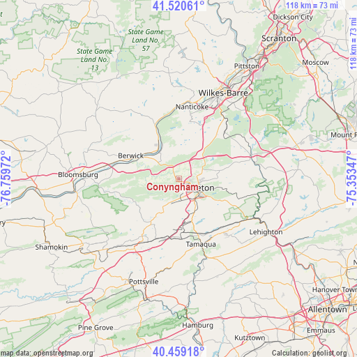
Conyngham GPS coordinates[2]
40° 59' 31.308" North, 76° 3' 23.724" West
| Map corner | latitude | longitude |
|---|---|---|
| Upper-left | 41.52061°, | -76.75972° |
| Center: | 40.99203°, | -76.05659° |
| Lower-right: | 40.45918°, | -75.35347° |
| Map W x H: | 118×118 km | = 73.3×73.3mi |
| max Lat: | 71.29058° ⇑34.3% North |
| Conyngham: | 40.99203° |
| min Lat: | ⇓65.7% South 19.06759° |
| min Long | Conyngham | max Long |
| -171.73463° | -76.05659° | -66.98998° |
| W 83.8%⇐ | ⇒16.2% E |
Elevation
Elevation of Conyngham is 297 m = 974 ft, and this is 2.2 m = 7 ft above average elevation for this country.
| Max E: |
3189 m = 10463 ft | 27.8% |
| Conyngham | 297 m 974 ft | |
| Avg. | 294.8 m = 967 ft | |
Min E: |
-60 m = -197 ft | 72.2% |
See also: United States elevation on elevation.city.
Geographical zone
Conyngham is located in North temperate zone (between Tropic of Cancer and the Arctic Circle). Distance of this Northern Tropic circle is 1952 km =1212.9 mi to South.| Distance of | km | miles | from Conyngham |
|---|---|---|---|
| North Pole | 5449.2 | 3386 | to North |
| Arctic Circle | 2843.3 | 1766.7 | to North |
| Tropic Cancer | 1952 | 1212.9 | to South |
| Equator | 4557.9 | 2832.1 | to South |


Nearby cities:
15 places around Conyngham: (largest is in red/bold)
• Beaver Meadows
13.9 km =8.6 mi,  120°
120°
• Beech Mountain Lakes
11.6 km =7.2 mi,  61°
61°
• Berwick
16.4 km =10.2 mi,  295°
295°
• East Berwick
15.9 km =9.9 mi, 299°
• Freeland
13.7 km =8.5 mi,  78°
78°
• Harleigh
7.3 km =4.5 mi,  100°
100°
• Hazleton
7.8 km =4.8 mi, 118°
• Kelayres
11.1 km =6.9 mi,  156°
156°
• Lattimer
8 km =5 mi,  88°
88°
• McAdoo
11.5 km =7.1 mi,  151°
151°
• Nescopeck
15.3 km =9.5 mi, 295°
• Oakdale
11.4 km =7.1 mi, 90°
• Pardeesville
7.7 km =4.8 mi, 81°
• Tresckow
11.6 km =7.2 mi,  139°
139°
• West Hazleton
6.3 km =3.9 mi,  126°
126°
Sources, notices
• [Note1] Compared only with cities in United States existing in our database
• [Src1] Map data: © OpenStreetMap contributors (CC-BY-SA)
• [Src2] Other city data from geonames.org with taken over terms of usage.
• [Src3] Geographical zone / Annual Mean Temperature by Robert A. Rohde @ Wikipedia
