Kelayres geodata
Kelayres (Pennsylvania) is a populated place; located in United States in America/New_York (GMT-4) time zone. With population of 533 people, there are 20466 cities with bigger population in this country. Compared to other cities in United States, 64.7% of cities are located further ↓South; 84% of cities are located further ←West and 88.6% of cities have lower elevation than Kelayres. Note1
Administrative division(s):
- Level 1: Pennsylvania
- Level 2: Schuylkill County
- Level 3: Township of Kline


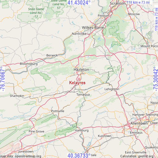
Kelayres GPS coordinates[2]
40° 54' 3.312" North, 76° 0' 12.744" West
| Map corner | latitude | longitude |
|---|---|---|
| Upper-left | 41.43024°, | -76.70667° |
| Center: | 40.90092°, | -76.00354° |
| Lower-right: | 40.36733°, | -75.30042° |
| Map W x H: | 118.2×118.2 km | = 73.4×73.4mi |
| max Lat: | 71.29058° ⇑35.3% North |
| Kelayres: | 40.90092° |
| min Lat: | ⇓64.7% South 19.06759° |
| min Long | Kelayres | max Long |
| -171.73463° | -76.00354° | -66.98998° |
| W 84%⇐ | ⇒16% E |
Elevation
Elevation of Kelayres is 536 m = 1759 ft, and this is 241.2 m = 791 ft above average elevation for this country.
| Max E: |
3189 m = 10463 ft | 11.4% |
| Kelayres | 536 m 1759 ft | |
| Avg. | 294.8 m = 967 ft | |
Min E: |
-60 m = -197 ft | 88.6% |
See also: United States elevation on elevation.city.
Geographical zone
Kelayres is located in North temperate zone (between Tropic of Cancer and the Arctic Circle). Distance of this Northern Tropic circle is 1941.8 km =1206.6 mi to South.| Distance of | km | miles | from Kelayres |
|---|---|---|---|
| North Pole | 5459.3 | 3392.3 | to North |
| Arctic Circle | 2853.4 | 1773 | to North |
| Tropic Cancer | 1941.8 | 1206.6 | to South |
| Equator | 4547.8 | 2825.9 | to South |


Nearby cities:
15 places around Kelayres: (largest is in red/bold)
• Beaver Meadows
8.1 km =5 mi,  67°
67°
• Coaldale
11.9 km =7.4 mi,  136°
136°
• Conyngham
11.1 km =6.9 mi,  336°
336°
• Harleigh
9.3 km =5.8 mi,  16°
16°
• Hazleton
6.8 km =4.2 mi, 20°
• Hometown
8.8 km =5.5 mi,  167°
167°
• Lansford
12.8 km =8 mi,  127°
127°
• Lattimer
10.9 km =6.8 mi, 18°
• McAdoo
1 km =0.6 mi,  87°
87°
• Oakdale
12.3 km =7.6 mi,  34°
34°
• Pardeesville
11.6 km =7.2 mi, 15°
• Park Crest
10.1 km =6.3 mi,  201°
201°
• Tamaqua
11.9 km =7.4 mi, 165°
• Tresckow
3.4 km =2.1 mi, 65°
• West Hazleton
6.5 km =4 mi,  5°
5°
Sources, notices
• [Note1] Compared only with cities in United States existing in our database
• [Src1] Map data: © OpenStreetMap contributors (CC-BY-SA)
• [Src2] Other city data from geonames.org with taken over terms of usage.
• [Src3] Geographical zone / Annual Mean Temperature by Robert A. Rohde @ Wikipedia
