Dewart geodata
Dewart (Pennsylvania) is a populated place; located in United States in America/New_York (GMT-4) time zone. With population of 1,471 people, there are 13789 cities with bigger population in this country. Compared to other cities in United States, 66.9% of cities are located further ↓South; 81.1% of cities are located further ←West and 61.3% of cities have higher elevation than Dewart. Note1
Administrative division(s):
- Level 1: Pennsylvania
- Level 2: Northumberland County
- Level 3: Township of Delaware


Dewart GPS coordinates[2]
41° 6' 33.3" North, 76° 52' 35.868" West
| Map corner | latitude | longitude |
|---|---|---|
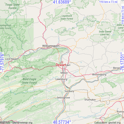
| Upper-left | 41.63689°, | -77.57976° |
| Center: | 41.10925°, | -76.87663° |
| Lower-right: | 40.57734°, | -76.17351° |
| Map W x H: | 117.8×117.8 km | = 73.2×73.2mi |
| max Lat: | 71.29058° ⇑33.1% North |
| Dewart: | 41.10925° |
| min Lat: | ⇓66.9% South 19.06759° |
| min Long | Dewart | max Long |
| -171.73463° | -76.87663° | -66.98998° |
| W 81.1%⇐ | ⇒18.9% E |
Elevation
Elevation of Dewart is 148 m = 486 ft, and this is 146.8 m = 482 ft below average elevation for this country.
| Max E: |
3189 m = 10463 ft | 61.3% |
| Avg. | 294.8 m = 967 ft | |
| Dewart | 148 m = 486 ft | |
Min E: |
-60 m = -197 ft | 38.7% |
See also: United States elevation on elevation.city.
Geographical zone
Dewart is located in North temperate zone (between Tropic of Cancer and the Arctic Circle). Distance of this Northern Tropic circle is 1965 km =1221 mi to South.| Distance of | km | miles | from Dewart |
|---|---|---|---|
| North Pole | 5436.1 | 3377.8 | to North |
| Arctic Circle | 2830.3 | 1758.7 | to North |
| Tropic Cancer | 1965 | 1221 | to South |
| Equator | 4570.9 | 2840.2 | to South |


Nearby cities:
15 places around Dewart: (largest is in red/bold)
• Faxon
17.6 km =10.9 mi,  331°
331°
• Kenmar
17.5 km =10.9 mi,  336°
336°
• Lewisburg
16.1 km =10 mi,  182°
182°
• Linntown
16.8 km =10.4 mi,  186°
186°
• Milton
11.1 km =6.9 mi,  167°
167°
• Montandon
16.1 km =10 mi, 172°
• Montgomery
6.8 km =4.2 mi,  359°
359°
• Montoursville
16.5 km =10.3 mi,  347°
347°
• Muncy
13.2 km =8.2 mi,  35°
35°
• New Columbia
7.6 km =4.7 mi, 173°
• South Williamsport
17.1 km =10.6 mi,  323°
323°
• Turbotville
8.9 km =5.5 mi,  95°
95°
• Warrior Run
6.1 km =3.8 mi, 102°
• Watsontown
2.9 km =1.8 mi,  158°
158°
• West Milton
9.9 km =6.2 mi, 177°
Sources, notices
• [Note1] Compared only with cities in United States existing in our database
• [Src1] Map data: © OpenStreetMap contributors (CC-BY-SA)
• [Src2] Other city data from geonames.org with taken over terms of usage.
• [Src3] Geographical zone / Annual Mean Temperature by Robert A. Rohde @ Wikipedia
