South Williamsport geodata
South Williamsport (Pennsylvania) is a populated place; located in United States in America/New_York (GMT-4) time zone. With population of 6,281 people, there are 6230 cities with bigger population in this country. Compared to other cities in United States, 68.1% of cities are located further ↓South; 80.6% of cities are located further ←West and 58% of cities have higher elevation than South Williamsport. Note1
Administrative division(s):
- Level 1: Pennsylvania
- Level 2: Lycoming County
- Level 3: Borough of South Williamsport


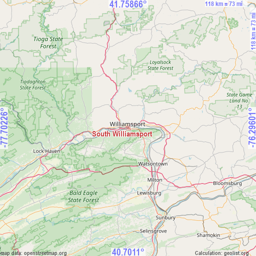
South Williamsport GPS coordinates[2]
41° 13' 55.272" North, 76° 59' 56.868" West
| Map corner | latitude | longitude |
|---|---|---|
| Upper-left | 41.75866°, | -77.70226° |
| Center: | 41.23202°, | -76.99913° |
| Lower-right: | 40.7011°, | -76.29601° |
| Map W x H: | 117.6×117.6 km | = 73.1×73.1mi |
| max Lat: | 71.29058° ⇑31.9% North |
| South Williamsport: | 41.23202° |
| min Lat: | ⇓68.1% South 19.06759° |
| min Long | South Williamsp | max Long |
| -171.73463° | -76.99913° | -66.98998° |
| W 80.6%⇐ | ⇒19.4% E |
Elevation
Elevation of South Williamsport is 165 m = 541 ft, and this is 129.8 m = 426 ft below average elevation for this country.
| Max E: |
3189 m = 10463 ft | 58% |
| Avg. | 294.8 m = 967 ft | |
| South Williamsport | 165 m = 541 ft | |
Min E: |
-60 m = -197 ft | 42% |
See also: United States elevation on elevation.city.
Geographical zone
South Williamsport is located in North temperate zone (between Tropic of Cancer and the Arctic Circle). Distance of this Northern Tropic circle is 1978.7 km =1229.5 mi to South.| Distance of | km | miles | from South Williamsport |
|---|---|---|---|
| North Pole | 5422.5 | 3369.4 | to North |
| Arctic Circle | 2816.6 | 1750.2 | to North |
| Tropic Cancer | 1978.7 | 1229.5 | to South |
| Equator | 4584.6 | 2848.7 | to South |


Nearby cities:
15 places around South Williamsport: (largest is in red/bold)
• Dewart
17.1 km =10.6 mi,  143°
143°
• Duboistown
3.3 km =2.1 mi,  251°
251°
• Faxon
2.6 km =1.6 mi,  45°
45°
• Garden View
4.6 km =2.9 mi,  302°
302°
• Hughesville
23 km =14.3 mi,  87°
87°
• Jersey Shore
22.4 km =13.9 mi,  261°
261°
• Kenmar
4.1 km =2.5 mi, 54°
• Montgomery
12.3 km =7.6 mi,  123°
123°
• Montoursville
7 km =4.3 mi,  69°
69°
• Muncy
18.1 km =11.2 mi,  99°
99°
• Rauchtown
23.3 km =14.5 mi,  238°
238°
• Turbotville
23.9 km =14.9 mi,  127°
127°
• Warrior Run
22.1 km =13.7 mi, 132°
• Watsontown
19.9 km =12.4 mi,  145°
145°
• Williamsport
1 km =0.6 mi,  350°
350°
Sources, notices
• [Note1] Compared only with cities in United States existing in our database
• [Src1] Map data: © OpenStreetMap contributors (CC-BY-SA)
• [Src2] Other city data from geonames.org with taken over terms of usage.
• [Src3] Geographical zone / Annual Mean Temperature by Robert A. Rohde @ Wikipedia
