Greenville geodata
Greenville (Pennsylvania) is a populated place; located in United States in America/New_York (GMT-4) time zone. With population of 5,819 people, there are 6525 cities with bigger population in this country. Compared to other cities in United States, 69.8% of cities are located further ↓South; 71.3% of cities are located further ←West and 70.4% of cities have lower elevation than Greenville. Note1
Administrative division(s):
- Level 1: Pennsylvania
- Level 2: Mercer County
- Level 3: Borough of Greenville


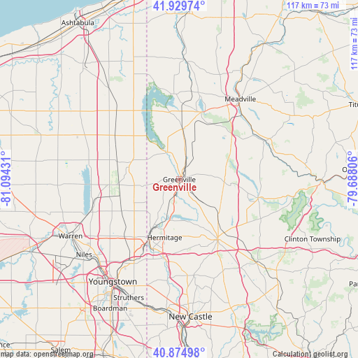
Greenville GPS coordinates[2]
41° 24' 16.2" North, 80° 23' 28.248" West
| Map corner | latitude | longitude |
|---|---|---|
| Upper-left | 41.92974°, | -81.09431° |
| Center: | 41.4045°, | -80.39118° |
| Lower-right: | 40.87498°, | -79.68806° |
| Map W x H: | 117.3×117.3 km | = 72.9×72.9mi |
| max Lat: | 71.29058° ⇑30.2% North |
| Greenville: | 41.4045° |
| min Lat: | ⇓69.8% South 19.06759° |
| min Long | Greenville | max Long |
| -171.73463° | -80.39118° | -66.98998° |
| W 71.3%⇐ | ⇒28.7% E |
Elevation
Elevation of Greenville is 288 m = 945 ft, and this is 6.8 m = 22 ft below average elevation for this country.
| Max E: |
3189 m = 10463 ft | 29.6% |
| Avg. | 294.8 m = 967 ft | |
| Greenville | 288 m = 945 ft | |
Min E: |
-60 m = -197 ft | 70.4% |
See also: United States elevation on elevation.city.
Geographical zone
Greenville is located in North temperate zone (between Tropic of Cancer and the Arctic Circle). Distance of this Northern Tropic circle is 1997.8 km =1241.4 mi to South.| Distance of | km | miles | from Greenville |
|---|---|---|---|
| North Pole | 5403.3 | 3357.5 | to North |
| Arctic Circle | 2797.4 | 1738.2 | to North |
| Tropic Cancer | 1997.8 | 1241.4 | to South |
| Equator | 4603.7 | 2860.6 | to South |


Nearby cities:
15 places around Greenville: (largest is in red/bold)
• Brookfield Center
22.9 km =14.2 mi,  217°
217°
• Clark
13.5 km =8.4 mi,  193°
193°
• Conneaut Lake
23.2 km =14.4 mi,  17°
17°
• Farrell
23.1 km =14.4 mi,  202°
202°
• Hermitage
19.6 km =12.2 mi, 194°
• Jamestown
9.7 km =6 mi,  336°
336°
• Kinsman Center
16.9 km =10.5 mi,  288°
288°
• Lake Latonka
21.6 km =13.4 mi,  125°
125°
• Mercer
23.4 km =14.5 mi,  147°
147°
• Pymatuning Central
21.4 km =13.3 mi, 339°
• Reynolds Heights
6.6 km =4.1 mi,  182°
182°
• Sharon
20.9 km =13 mi, 204°
• Sharpsville
17.5 km =10.9 mi, 202°
• West Hill
21.9 km =13.6 mi,  209°
209°
• Wheatland
24.3 km =15.1 mi, 201°
Sources, notices
• [Note1] Compared only with cities in United States existing in our database
• [Src1] Map data: © OpenStreetMap contributors (CC-BY-SA)
• [Src2] Other city data from geonames.org with taken over terms of usage.
• [Src3] Geographical zone / Annual Mean Temperature by Robert A. Rohde @ Wikipedia
