Reynolds Heights geodata
Reynolds Heights (Pennsylvania) is a populated place; located in United States in America/New_York (GMT-4) time zone. With population of 2,061 people, there are 11753 cities with bigger population in this country. Compared to other cities in United States, 69.3% of cities are located further ↓South; 71.2% of cities are located further ←West and 76.6% of cities have lower elevation than Reynolds Heights. Note1
Administrative division(s):
- Level 1: Pennsylvania
- Level 2: Mercer County
- Level 3: Township of Pymatuning


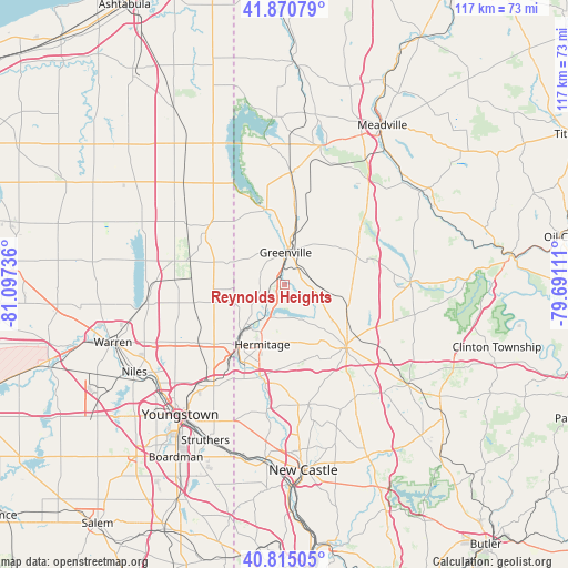
Reynolds Heights GPS coordinates[2]
41° 20' 42.216" North, 80° 23' 39.228" West
| Map corner | latitude | longitude |
|---|---|---|
| Upper-left | 41.87079°, | -81.09736° |
| Center: | 41.34506°, | -80.39423° |
| Lower-right: | 40.81505°, | -79.69111° |
| Map W x H: | 117.4×117.4 km | = 72.9×72.9mi |
| max Lat: | 71.29058° ⇑30.7% North |
| Reynolds Heights: | 41.34506° |
| min Lat: | ⇓69.3% South 19.06759° |
| min Long | Reynolds Height | max Long |
| -171.73463° | -80.39423° | -66.98998° |
| W 71.2%⇐ | ⇒28.8% E |
Elevation
Elevation of Reynolds Heights is 325 m = 1066 ft, and this is 30.2 m = 99 ft above average elevation for this country.
| Max E: |
3189 m = 10463 ft | 23.4% |
| Reynolds Heights | 325 m 1066 ft | |
| Avg. | 294.8 m = 967 ft | |
Min E: |
-60 m = -197 ft | 76.6% |
See also: United States elevation on elevation.city.
Geographical zone
Reynolds Heights is located in North temperate zone (between Tropic of Cancer and the Arctic Circle). Distance of this Northern Tropic circle is 1991.2 km =1237.3 mi to South.| Distance of | km | miles | from Reynolds Heights |
|---|---|---|---|
| North Pole | 5409.9 | 3361.6 | to North |
| Arctic Circle | 2804 | 1742.3 | to North |
| Tropic Cancer | 1991.2 | 1237.3 | to South |
| Equator | 4597.1 | 2856.5 | to South |


Nearby cities:
15 places around Reynolds Heights: (largest is in red/bold)
• Brookfield Center
17.9 km =11.1 mi,  229°
229°
• Clark
7.1 km =4.4 mi,  203°
203°
• Farrell
17.1 km =10.6 mi,  210°
210°
• Greenville
6.6 km =4.1 mi,  2°
2°
• Hermitage
13.2 km =8.2 mi, 200°
• Jamestown
16 km =9.9 mi,  346°
346°
• Kinsman Center
19.8 km =12.3 mi,  307°
307°
• Lake Latonka
18.8 km =11.7 mi,  108°
108°
• Masury
19.1 km =11.9 mi,  218°
218°
• Mercer
18.4 km =11.4 mi,  135°
135°
• Sharon
15 km =9.3 mi, 213°
• Sharpsville
11.5 km =7.1 mi, 214°
• West Hill
16.3 km =10.1 mi, 219°
• West Middlesex
19.6 km =12.2 mi,  194°
194°
• Wheatland
18.2 km =11.3 mi, 208°
Sources, notices
• [Note1] Compared only with cities in United States existing in our database
• [Src1] Map data: © OpenStreetMap contributors (CC-BY-SA)
• [Src2] Other city data from geonames.org with taken over terms of usage.
• [Src3] Geographical zone / Annual Mean Temperature by Robert A. Rohde @ Wikipedia
