Irvona geodata
Irvona (Pennsylvania) is a populated place; located in United States in America/New_York (GMT-4) time zone. With population of 625 people, there are 19413 cities with bigger population in this country. Compared to other cities in United States, 62.7% of cities are located further ↓South; 76.8% of cities are located further ←West and 85.1% of cities have lower elevation than Irvona. Note1
Administrative division(s):
- Level 1: Pennsylvania
- Level 2: Clearfield County
- Level 3: Borough of Irvona


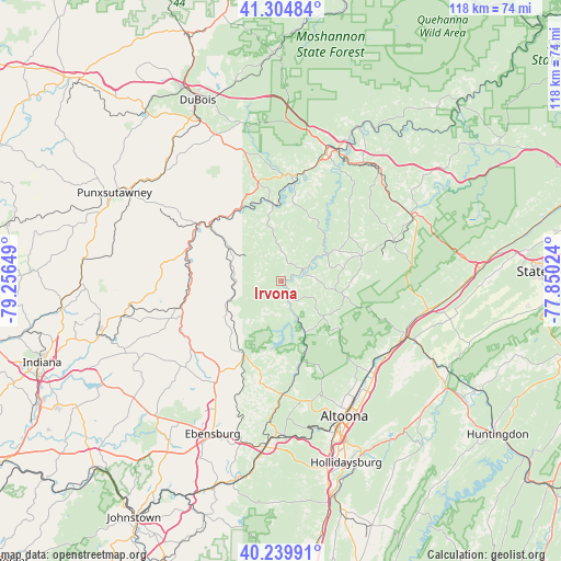
Irvona GPS coordinates[2]
40° 46' 28.236" North, 78° 33' 12.096" West
| Map corner | latitude | longitude |
|---|---|---|
| Upper-left | 41.30484°, | -79.25649° |
| Center: | 40.77451°, | -78.55336° |
| Lower-right: | 40.23991°, | -77.85024° |
| Map W x H: | 118.4×118.4 km | = 73.6×73.6mi |
| max Lat: | 71.29058° ⇑37.3% North |
| Irvona: | 40.77451° |
| min Lat: | ⇓62.7% South 19.06759° |
| min Long | Irvona | max Long |
| -171.73463° | -78.55336° | -66.98998° |
| W 76.8%⇐ | ⇒23.2% E |
Elevation
Elevation of Irvona is 427 m = 1401 ft, and this is 132.2 m = 434 ft above average elevation for this country.
| Max E: |
3189 m = 10463 ft | 14.9% |
| Irvona | 427 m 1401 ft | |
| Avg. | 294.8 m = 967 ft | |
Min E: |
-60 m = -197 ft | 85.1% |
See also: United States elevation on elevation.city.
Geographical zone
Irvona is located in North temperate zone (between Tropic of Cancer and the Arctic Circle). Distance of this Northern Tropic circle is 1927.8 km =1197.9 mi to South.| Distance of | km | miles | from Irvona |
|---|---|---|---|
| North Pole | 5473.4 | 3401 | to North |
| Arctic Circle | 2867.5 | 1781.8 | to North |
| Tropic Cancer | 1927.8 | 1197.9 | to South |
| Equator | 4533.7 | 2817.1 | to South |


Nearby cities:
15 places around Irvona: (largest is in red/bold)
• Barnesboro
22.8 km =14.2 mi,  236°
236°
• Bellwood
27.1 km =16.8 mi,  134°
134°
• Carrolltown
23.1 km =14.4 mi,  214°
214°
• Coalport
3.4 km =2.1 mi,  151°
151°
• Curwensville
22.5 km =14 mi,  6°
6°
• Grazierville
27.8 km =17.3 mi,  118°
118°
• Hastings
18.1 km =11.2 mi,  227°
227°
• Houtzdale
17.9 km =11.1 mi,  71°
71°
• Hyde
26.5 km =16.5 mi,  16°
16°
• Northern Cambria
23.1 km =14.4 mi, 236°
• Osceola Mills
25.2 km =15.7 mi, 70°
• Patton
17.6 km =10.9 mi, 207°
• Spangler
23.6 km =14.7 mi, 231°
• Tipton
26.6 km =16.5 mi, 125°
• West Decatur
28.8 km =17.9 mi,  53°
53°
Sources, notices
• [Note1] Compared only with cities in United States existing in our database
• [Src1] Map data: © OpenStreetMap contributors (CC-BY-SA)
• [Src2] Other city data from geonames.org with taken over terms of usage.
• [Src3] Geographical zone / Annual Mean Temperature by Robert A. Rohde @ Wikipedia
