Grazierville geodata
Grazierville (Pennsylvania) is a populated place; located in United States in America/New_York (GMT-4) time zone. With population of 665 people, there are 19022 cities with bigger population in this country. Compared to other cities in United States, 60.9% of cities are located further ↓South; 77.3% of cities are located further ←West and 70.3% of cities have lower elevation than Grazierville. Note1


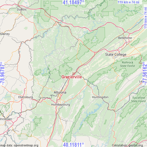
Grazierville GPS coordinates[2]
40° 39' 13.212" North, 78° 15' 53.064" West
| Map corner | latitude | longitude |
|---|---|---|
| Upper-left | 41.18497°, | -78.96787° |
| Center: | 40.65367°, | -78.26474° |
| Lower-right: | 40.11811°, | -77.56162° |
| Map W x H: | 118.6×118.6 km | = 73.7×73.7mi |
| max Lat: | 71.29058° ⇑39.1% North |
| Grazierville: | 40.65367° |
| min Lat: | ⇓60.9% South 19.06759° |
| min Long | Grazierville | max Long |
| -171.73463° | -78.26474° | -66.98998° |
| W 77.3%⇐ | ⇒22.7% E |
Elevation
Elevation of Grazierville is 287 m = 942 ft, and this is 7.8 m = 26 ft below average elevation for this country.
| Max E: |
3189 m = 10463 ft | 29.7% |
| Avg. | 294.8 m = 967 ft | |
| Grazierville | 287 m = 942 ft | |
Min E: |
-60 m = -197 ft | 70.3% |
See also: United States elevation on elevation.city.
Geographical zone
Grazierville is located in North temperate zone (between Tropic of Cancer and the Arctic Circle). Distance of this Northern Tropic circle is 1914.3 km =1189.5 mi to South.| Distance of | km | miles | from Grazierville |
|---|---|---|---|
| North Pole | 5486.8 | 3409.3 | to North |
| Arctic Circle | 2880.9 | 1790.1 | to North |
| Tropic Cancer | 1914.3 | 1189.5 | to South |
| Equator | 4520.3 | 2808.8 | to South |


Nearby cities:
15 places around Grazierville: (largest is in red/bold)
• Altoona
18.6 km =11.6 mi,  216°
216°
• Bellwood
7.5 km =4.7 mi, 222°
• Chester Hill
26.4 km =16.4 mi,  6°
6°
• Coalport
25 km =15.5 mi,  294°
294°
• Greenwood
15.3 km =9.5 mi,  210°
210°
• Houtzdale
20.4 km =12.7 mi,  339°
339°
• Lakemont
22.7 km =14.1 mi, 207°
• Osceola Mills
21.8 km =13.5 mi,  358°
358°
• Philipsburg
27.2 km =16.9 mi, 7°
• Port Matilda
24 km =14.9 mi,  47°
47°
• Ramblewood
27 km =16.8 mi,  74°
74°
• Stormstown
26 km =16.2 mi, 53°
• Tipton
3.3 km =2.1 mi,  233°
233°
• Tyrone
2.9 km =1.8 mi, 49°
• Williamsburg
22 km =13.7 mi,  165°
165°
Sources, notices
• [Note1] Compared only with cities in United States existing in our database
• [Src1] Map data: © OpenStreetMap contributors (CC-BY-SA)
• [Src2] Other city data from geonames.org with taken over terms of usage.
• [Src3] Geographical zone / Annual Mean Temperature by Robert A. Rohde @ Wikipedia
