Jennerstown geodata
Jennerstown (Pennsylvania) is a populated place; located in United States in America/New_York (GMT-4) time zone. With population of 669 people, there are 18982 cities with bigger population in this country. Compared to other cities in United States, 55.2% of cities are located further ↓South; 75.6% of cities are located further ←West and 89.5% of cities have lower elevation than Jennerstown. Note1
Administrative division(s):
- Level 1: Pennsylvania
- Level 2: Somerset County
- Level 3: Borough of Jennerstown


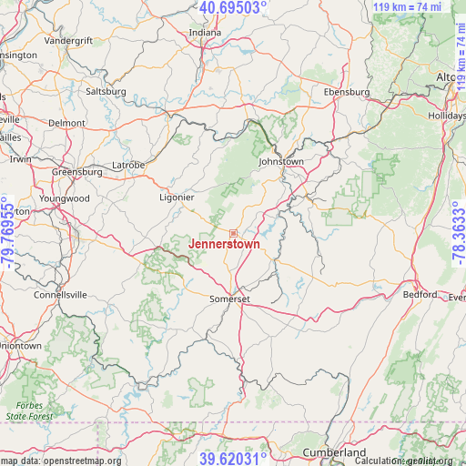
Jennerstown GPS coordinates[2]
40° 9' 35.28" North, 79° 3' 59.112" West
| Map corner | latitude | longitude |
|---|---|---|
| Upper-left | 40.69503°, | -79.76955° |
| Center: | 40.1598°, | -79.06642° |
| Lower-right: | 39.62031°, | -78.3633° |
| Map W x H: | 119.5×119.5 km | = 74.3×74.3mi |
| max Lat: | 71.29058° ⇑44.8% North |
| Jennerstown: | 40.1598° |
| min Lat: | ⇓55.2% South 19.06759° |
| min Long | Jennerstown | max Long |
| -171.73463° | -79.06642° | -66.98998° |
| W 75.6%⇐ | ⇒24.4% E |
Elevation
Elevation of Jennerstown is 592 m = 1942 ft, and this is 297.2 m = 975 ft above average elevation for this country.
| Max E: |
3189 m = 10463 ft | 10.5% |
| Jennerstown | 592 m 1942 ft | |
| Avg. | 294.8 m = 967 ft | |
Min E: |
-60 m = -197 ft | 89.5% |
See also: United States elevation on elevation.city.
Geographical zone
Jennerstown is located in North temperate zone (between Tropic of Cancer and the Arctic Circle). Distance of this Northern Tropic circle is 1859.4 km =1155.4 mi to South.| Distance of | km | miles | from Jennerstown |
|---|---|---|---|
| North Pole | 5541.7 | 3443.5 | to North |
| Arctic Circle | 2935.8 | 1824.2 | to North |
| Tropic Cancer | 1859.4 | 1155.4 | to South |
| Equator | 4465.4 | 2774.7 | to South |


Nearby cities:
15 places around Jennerstown: (largest is in red/bold)
• Belmont
20.7 km =12.9 mi,  46°
46°
• Boswell
3.2 km =2 mi,  86°
86°
• Davidsville
13.3 km =8.3 mi,  55°
55°
• Elim
18.6 km =11.6 mi,  34°
34°
• Ferndale
19.3 km =12 mi,  41°
41°
• Friedens
13.5 km =8.4 mi,  154°
154°
• Hooversville
13.2 km =8.2 mi,  96°
96°
• Jerome
8.9 km =5.5 mi, 52°
• Ligonier
17.2 km =10.7 mi,  302°
302°
• Paint
20.7 km =12.9 mi, 63°
• Scalp Level
21 km =13 mi, 61°
• Somerset
16.9 km =10.5 mi,  183°
183°
• Southmont
20 km =12.4 mi, 32°
• Waterford
13.6 km =8.5 mi,  320°
320°
• Westmont
19.9 km =12.4 mi, 29°
Sources, notices
• [Note1] Compared only with cities in United States existing in our database
• [Src1] Map data: © OpenStreetMap contributors (CC-BY-SA)
• [Src2] Other city data from geonames.org with taken over terms of usage.
• [Src3] Geographical zone / Annual Mean Temperature by Robert A. Rohde @ Wikipedia
