Jersey Shore geodata
Jersey Shore (Pennsylvania) is a populated place; located in United States in America/New_York (GMT-4) time zone. With population of 4,279 people, there are 7886 cities with bigger population in this country. Compared to other cities in United States, 67.8% of cities are located further ↓South; 79.6% of cities are located further ←West and 54.8% of cities have higher elevation than Jersey Shore. Note1
Administrative division(s):
- Level 1: Pennsylvania
- Level 2: Lycoming County
- Level 3: Borough of Jersey Shore


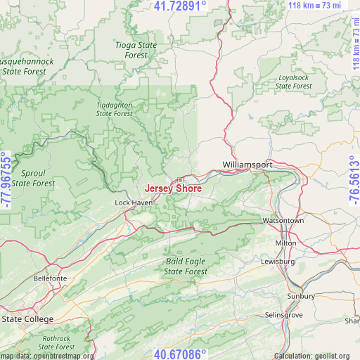
Jersey Shore GPS coordinates[2]
41° 12' 7.272" North, 77° 15' 51.912" West
| Map corner | latitude | longitude |
|---|---|---|
| Upper-left | 41.72891°, | -77.96755° |
| Center: | 41.20202°, | -77.26442° |
| Lower-right: | 40.67086°, | -76.5613° |
| Map W x H: | 117.6×117.6 km | = 73.1×73.1mi |
| max Lat: | 71.29058° ⇑32.2% North |
| Jersey Shore: | 41.20202° |
| min Lat: | ⇓67.8% South 19.06759° |
| min Long | Jersey Shore | max Long |
| -171.73463° | -77.26442° | -66.98998° |
| W 79.6%⇐ | ⇒20.4% E |
Elevation
Elevation of Jersey Shore is 181 m = 594 ft, and this is 113.8 m = 373 ft below average elevation for this country.
| Max E: |
3189 m = 10463 ft | 54.8% |
| Avg. | 294.8 m = 967 ft | |
| Jersey Shore | 181 m = 594 ft | |
Min E: |
-60 m = -197 ft | 45.2% |
See also: United States elevation on elevation.city.
Geographical zone
Jersey Shore is located in North temperate zone (between Tropic of Cancer and the Arctic Circle). Distance of this Northern Tropic circle is 1975.3 km =1227.4 mi to South.| Distance of | km | miles | from Jersey Shore |
|---|---|---|---|
| North Pole | 5425.8 | 3371.4 | to North |
| Arctic Circle | 2819.9 | 1752.2 | to North |
| Tropic Cancer | 1975.3 | 1227.4 | to South |
| Equator | 4581.2 | 2846.6 | to South |


Nearby cities:
15 places around Jersey Shore: (largest is in red/bold)
• Avis
4.6 km =2.9 mi,  245°
245°
• Castanea
16.3 km =10.1 mi,  238°
238°
• Duboistown
19.2 km =11.9 mi,  83°
83°
• Dunnstown
14.5 km =9 mi, 244°
• Faxon
24.6 km =15.3 mi, 77°
• Flemington
19.3 km =12 mi, 244°
• Garden View
19.2 km =11.9 mi,  72°
72°
• Kenmar
26.1 km =16.2 mi, 77°
• Lock Haven
16.9 km =10.5 mi, 244°
• McElhattan
9.4 km =5.8 mi, 239°
• Mill Hall
21.2 km =13.2 mi, 240°
• Rauchtown
9.1 km =5.7 mi,  164°
164°
• Rote
18.9 km =11.7 mi,  223°
223°
• South Williamsport
22.4 km =13.9 mi, 81°
• Williamsport
22.5 km =14 mi, 78°
Sources, notices
• [Note1] Compared only with cities in United States existing in our database
• [Src1] Map data: © OpenStreetMap contributors (CC-BY-SA)
• [Src2] Other city data from geonames.org with taken over terms of usage.
• [Src3] Geographical zone / Annual Mean Temperature by Robert A. Rohde @ Wikipedia
