Johnsonburg geodata
Johnsonburg (Pennsylvania) is a populated place; located in United States in America/New_York (GMT-4) time zone. With population of 2,371 people, there are 10922 cities with bigger population in this country. Compared to other cities in United States, 70.8% of cities are located further ↓South; 76.6% of cities are located further ←West and 86.3% of cities have lower elevation than Johnsonburg. Note1
Administrative division(s):
- Level 1: Pennsylvania
- Level 2: Elk County
- Level 3: Borough of Johnsonburg


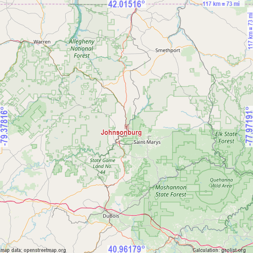
Johnsonburg GPS coordinates[2]
41° 29' 26.232" North, 78° 40' 30.108" West
| Map corner | latitude | longitude |
|---|---|---|
| Upper-left | 42.01516°, | -79.37816° |
| Center: | 41.49062°, | -78.67503° |
| Lower-right: | 40.96179°, | -77.97191° |
| Map W x H: | 117.1×117.1 km | = 72.8×72.8mi |
| max Lat: | 71.29058° ⇑29.2% North |
| Johnsonburg: | 41.49062° |
| min Lat: | ⇓70.8% South 19.06759° |
| min Long | Johnsonburg | max Long |
| -171.73463° | -78.67503° | -66.98998° |
| W 76.6%⇐ | ⇒23.4% E |
Elevation
Elevation of Johnsonburg is 450 m = 1476 ft, and this is 155.2 m = 509 ft above average elevation for this country.
| Max E: |
3189 m = 10463 ft | 13.7% |
| Johnsonburg | 450 m 1476 ft | |
| Avg. | 294.8 m = 967 ft | |
Min E: |
-60 m = -197 ft | 86.3% |
See also: United States elevation on elevation.city.
Geographical zone
Johnsonburg is located in North temperate zone (between Tropic of Cancer and the Arctic Circle). Distance of this Northern Tropic circle is 2007.4 km =1247.3 mi to South.| Distance of | km | miles | from Johnsonburg |
|---|---|---|---|
| North Pole | 5393.7 | 3351.5 | to North |
| Arctic Circle | 2787.8 | 1732.3 | to North |
| Tropic Cancer | 2007.4 | 1247.3 | to South |
| Equator | 4613.3 | 2866.6 | to South |


Nearby cities:
15 places around Johnsonburg: (largest is in red/bold)
• Brockway
28.8 km =17.9 mi,  201°
201°
• DuBois
41.9 km =26 mi,  189°
189°
• Emporium
36.7 km =22.8 mi,  86°
86°
• Falls Creek
39.9 km =24.8 mi, 195°
• Kane
22.2 km =13.8 mi,  329°
329°
• Kersey
15.7 km =9.8 mi,  155°
155°
• Marienville
37.4 km =23.2 mi,  266°
266°
• Mount Jewett
26.3 km =16.3 mi,  6°
6°
• Oklahoma
42.2 km =26.2 mi, 186°
• Ridgway
9 km =5.6 mi,  209°
209°
• Saint Marys
11.8 km =7.3 mi,  126°
126°
• Sheffield
38.2 km =23.7 mi,  308°
308°
• Smethport
40.5 km =25.2 mi,  28°
28°
• Treasure Lake
35.4 km =22 mi, 185°
• Weedville
28.3 km =17.6 mi,  147°
147°
Sources, notices
• [Note1] Compared only with cities in United States existing in our database
• [Src1] Map data: © OpenStreetMap contributors (CC-BY-SA)
• [Src2] Other city data from geonames.org with taken over terms of usage.
• [Src3] Geographical zone / Annual Mean Temperature by Robert A. Rohde @ Wikipedia
