Lehighton geodata
Lehighton (Pennsylvania) is a populated place; located in United States in America/New_York (GMT-4) time zone. With population of 5,314 people, there are 6898 cities with bigger population in this country. Compared to other cities in United States, 63.7% of cities are located further ↓South; 85% of cities are located further ←West and 55.7% of cities have higher elevation than Lehighton. Note1
Administrative division(s):
- Level 1: Pennsylvania
- Level 2: Carbon County
- Level 3: Borough of Lehighton


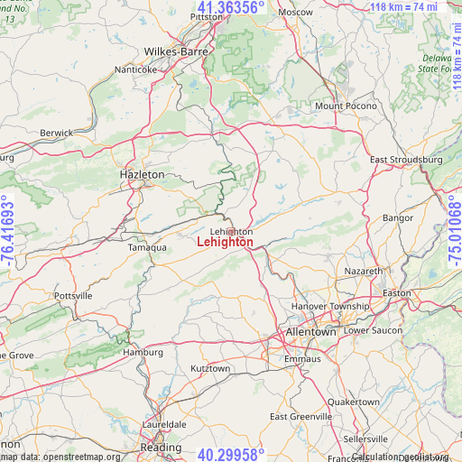
Lehighton GPS coordinates[2]
40° 50' 1.32" North, 75° 42' 49.68" West
| Map corner | latitude | longitude |
|---|---|---|
| Upper-left | 41.36356°, | -76.41693° |
| Center: | 40.8337°, | -75.7138° |
| Lower-right: | 40.29958°, | -75.01068° |
| Map W x H: | 118.3×118.3 km | = 73.5×73.5mi |
| max Lat: | 71.29058° ⇑36.3% North |
| Lehighton: | 40.8337° |
| min Lat: | ⇓63.7% South 19.06759° |
| min Long | Lehighton | max Long |
| -171.73463° | -75.7138° | -66.98998° |
| W 85%⇐ | ⇒15% E |
Elevation
Elevation of Lehighton is 177 m = 581 ft, and this is 117.8 m = 386 ft below average elevation for this country.
| Max E: |
3189 m = 10463 ft | 55.7% |
| Avg. | 294.8 m = 967 ft | |
| Lehighton | 177 m = 581 ft | |
Min E: |
-60 m = -197 ft | 44.3% |
See also: United States elevation on elevation.city.
Geographical zone
Lehighton is located in North temperate zone (between Tropic of Cancer and the Arctic Circle). Distance of this Northern Tropic circle is 1934.4 km =1202 mi to South.| Distance of | km | miles | from Lehighton |
|---|---|---|---|
| North Pole | 5466.8 | 3396.9 | to North |
| Arctic Circle | 2860.9 | 1777.7 | to North |
| Tropic Cancer | 1934.4 | 1202 | to South |
| Equator | 4540.3 | 2821.2 | to South |


Nearby cities:
15 places around Lehighton: (largest is in red/bold)
• Bowmanstown
5.8 km =3.6 mi,  130°
130°
• Cherryville
17.2 km =10.7 mi,  120°
120°
• Coaldale
16.3 km =10.1 mi,  265°
265°
• Jim Thorpe
4.9 km =3 mi,  341°
341°
• Lansford
14.2 km =8.8 mi, 269°
• Nesquehoning
8.9 km =5.5 mi,  292°
292°
• New Tripoli
17.3 km =10.7 mi,  190°
190°
• Palmerton
9.3 km =5.8 mi,  112°
112°
• Parryville
3.9 km =2.4 mi, 116°
• Schnecksville
19.3 km =12 mi,  155°
155°
• Slatington
12.8 km =8 mi,  137°
137°
• Summit Hill
13.3 km =8.3 mi, 265°
• Walnutport
13.1 km =8.1 mi, 132°
• Weatherly
15.5 km =9.6 mi,  320°
320°
• Weissport East
2.3 km =1.4 mi,  81°
81°
Sources, notices
• [Note1] Compared only with cities in United States existing in our database
• [Src1] Map data: © OpenStreetMap contributors (CC-BY-SA)
• [Src2] Other city data from geonames.org with taken over terms of usage.
• [Src3] Geographical zone / Annual Mean Temperature by Robert A. Rohde @ Wikipedia
