Lewistown geodata
Lewistown (Pennsylvania) is a seat of a second-order administrative division; located in United States in America/New_York (GMT-4) time zone. With population of 8,271 people, there are 5155 cities with bigger population in this country. Compared to other cities in United States, 60% of cities are located further ↓South; 78.7% of cities are located further ←West and 59.9% of cities have higher elevation than Lewistown. Note1
Administrative division(s):
- Level 1: Pennsylvania
- Level 2: Mifflin County
- Level 3: Borough of Lewistown


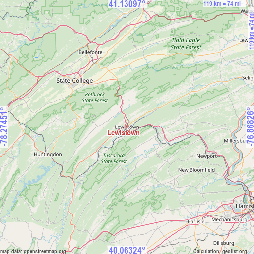
Lewistown GPS coordinates[2]
40° 35' 57.264" North, 77° 34' 16.968" West
| Map corner | latitude | longitude |
|---|---|---|
| Upper-left | 41.13097°, | -78.27451° |
| Center: | 40.59924°, | -77.57138° |
| Lower-right: | 40.06324°, | -76.86826° |
| Map W x H: | 118.7×118.7 km | = 73.8×73.8mi |
| max Lat: | 71.29058° ⇑40% North |
| Lewistown: | 40.59924° |
| min Lat: | ⇓60% South 19.06759° |
| min Long | Lewistown | max Long |
| -171.73463° | -77.57138° | -66.98998° |
| W 78.7%⇐ | ⇒21.3% E |
Elevation
Elevation of Lewistown is 155 m = 509 ft, and this is 139.8 m = 459 ft below average elevation for this country.
| Max E: |
3189 m = 10463 ft | 59.9% |
| Avg. | 294.8 m = 967 ft | |
| Lewistown | 155 m = 509 ft | |
Min E: |
-60 m = -197 ft | 40.1% |
See also: United States elevation on elevation.city.
Geographical zone
Lewistown is located in North temperate zone (between Tropic of Cancer and the Arctic Circle). Distance of this Northern Tropic circle is 1908.3 km =1185.8 mi to South.| Distance of | km | miles | from Lewistown |
|---|---|---|---|
| North Pole | 5492.8 | 3413.1 | to North |
| Arctic Circle | 2887 | 1793.9 | to North |
| Tropic Cancer | 1908.3 | 1185.8 | to South |
| Equator | 4514.2 | 2805 | to South |


Nearby cities:
15 places around Lewistown: (largest is in red/bold)
• Allensville
21.9 km =13.6 mi,  251°
251°
• Belleville
13 km =8.1 mi,  272°
272°
• Burnham
4.4 km =2.7 mi,  3°
3°
• Church Hill
9.5 km =5.9 mi,  345°
345°
• Highland Park
2.4 km =1.5 mi,  6°
6°
• Juniata Terrace
1.6 km =1 mi,  201°
201°
• McAlisterville
25.4 km =15.8 mi,  80°
80°
• McClure
24.8 km =15.4 mi,  61°
61°
• Mifflin
14.6 km =9.1 mi,  103°
103°
• Mifflintown
15.1 km =9.4 mi, 102°
• Milroy
12.9 km =8 mi, 352°
• Port Royal
17.3 km =10.7 mi,  114°
114°
• Reedsville
7.5 km =4.7 mi,  344°
344°
• Strodes Mills
10.1 km =6.3 mi,  237°
237°
• Yeagertown
4.9 km =3 mi, 350°
Sources, notices
• [Note1] Compared only with cities in United States existing in our database
• [Src1] Map data: © OpenStreetMap contributors (CC-BY-SA)
• [Src2] Other city data from geonames.org with taken over terms of usage.
• [Src3] Geographical zone / Annual Mean Temperature by Robert A. Rohde @ Wikipedia
