Plymptonville geodata
Plymptonville (Pennsylvania) is a populated place; located in United States in America/New_York (GMT-4) time zone. With population of 981 people, there are 16400 cities with bigger population in this country. Compared to other cities in United States, 66.4% of cities are located further ↓South; 77% of cities are located further ←West and 85.4% of cities have lower elevation than Plymptonville. Note1
Administrative division(s):
- Level 1: Pennsylvania
- Level 2: Clearfield County
- Level 3: Township of Lawrence


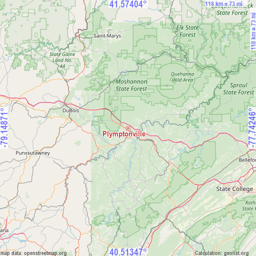
Plymptonville GPS coordinates[2]
41° 2' 45.204" North, 78° 26' 44.088" West
| Map corner | latitude | longitude |
|---|---|---|
| Upper-left | 41.57404°, | -79.14871° |
| Center: | 41.04589°, | -78.44558° |
| Lower-right: | 40.51347°, | -77.74246° |
| Map W x H: | 117.9×117.9 km | = 73.3×73.3mi |
| max Lat: | 71.29058° ⇑33.6% North |
| Plymptonville: | 41.04589° |
| min Lat: | ⇓66.4% South 19.06759° |
| min Long | Plymptonville | max Long |
| -171.73463° | -78.44558° | -66.98998° |
| W 77%⇐ | ⇒23% E |
Elevation
Elevation of Plymptonville is 432 m = 1417 ft, and this is 137.2 m = 450 ft above average elevation for this country.
| Max E: |
3189 m = 10463 ft | 14.6% |
| Plymptonville | 432 m 1417 ft | |
| Avg. | 294.8 m = 967 ft | |
Min E: |
-60 m = -197 ft | 85.4% |
See also: United States elevation on elevation.city.
Geographical zone
Plymptonville is located in North temperate zone (between Tropic of Cancer and the Arctic Circle). Distance of this Northern Tropic circle is 1958 km =1216.6 mi to South.| Distance of | km | miles | from Plymptonville |
|---|---|---|---|
| North Pole | 5443.2 | 3382.2 | to North |
| Arctic Circle | 2837.3 | 1763 | to North |
| Tropic Cancer | 1958 | 1216.6 | to South |
| Equator | 4563.9 | 2835.9 | to South |


Nearby cities:
15 places around Plymptonville: (largest is in red/bold)
• Chester Hill
25.2 km =15.7 mi,  133°
133°
• Clearfield
2.1 km =1.3 mi,  165°
165°
• Curwensville
10.3 km =6.4 mi,  220°
220°
• Hawk Run
24.2 km =15 mi,  124°
124°
• Houtzdale
25.8 km =16 mi,  162°
162°
• Hyde
5 km =3.1 mi,  196°
196°
• Morrisdale
21.4 km =13.3 mi, 120°
• North Philipsburg
25.2 km =15.7 mi, 127°
• Oklahoma
25.3 km =15.7 mi,  287°
287°
• Osceola Mills
26.3 km =16.3 mi,  145°
145°
• Philipsburg
25.2 km =15.7 mi, 131°
• Shiloh
12.9 km =8 mi,  92°
92°
• Troy
24.1 km =15 mi, 127°
• Weedville
26 km =16.2 mi,  351°
351°
• West Decatur
19.2 km =11.9 mi, 132°
Sources, notices
• [Note1] Compared only with cities in United States existing in our database
• [Src1] Map data: © OpenStreetMap contributors (CC-BY-SA)
• [Src2] Other city data from geonames.org with taken over terms of usage.
• [Src3] Geographical zone / Annual Mean Temperature by Robert A. Rohde @ Wikipedia
