Ravine geodata
Ravine (Pennsylvania) is a populated place; located in United States in America/New_York (GMT-4) time zone. With population of 662 people, there are 19049 cities with bigger population in this country. Compared to other cities in United States, 59.7% of cities are located further ↓South; 82.9% of cities are located further ←West and 56% of cities have higher elevation than Ravine. Note1
Administrative division(s):
- Level 1: Pennsylvania
- Level 2: Schuylkill County
- Level 3: Township of Pine Grove


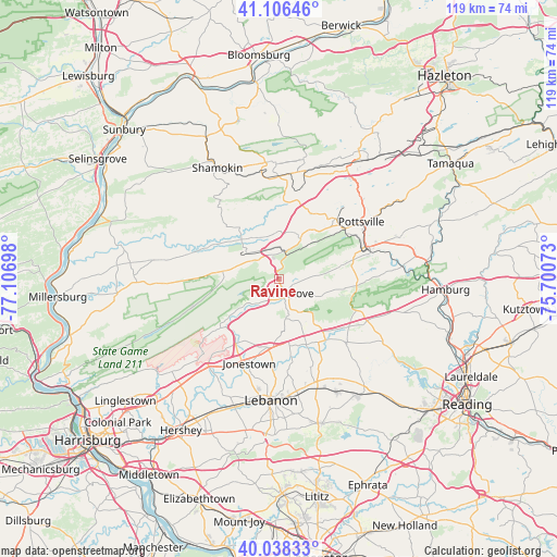
Ravine GPS coordinates[2]
40° 34' 28.308" North, 76° 24' 13.86" West
| Map corner | latitude | longitude |
|---|---|---|
| Upper-left | 41.10646°, | -77.10698° |
| Center: | 40.57453°, | -76.40385° |
| Lower-right: | 40.03833°, | -75.70073° |
| Map W x H: | 118.8×118.8 km | = 73.8×73.8mi |
| max Lat: | 71.29058° ⇑40.3% North |
| Ravine: | 40.57453° |
| min Lat: | ⇓59.7% South 19.06759° |
| min Long | Ravine | max Long |
| -171.73463° | -76.40385° | -66.98998° |
| W 82.9%⇐ | ⇒17.1% E |
Elevation
Elevation of Ravine is 176 m = 577 ft, and this is 118.8 m = 390 ft below average elevation for this country.
| Max E: |
3189 m = 10463 ft | 56% |
| Avg. | 294.8 m = 967 ft | |
| Ravine | 176 m = 577 ft | |
Min E: |
-60 m = -197 ft | 44% |
See also: United States elevation on elevation.city.
Geographical zone
Ravine is located in North temperate zone (between Tropic of Cancer and the Arctic Circle). Distance of this Northern Tropic circle is 1905.5 km =1184 mi to South.| Distance of | km | miles | from Ravine |
|---|---|---|---|
| North Pole | 5495.6 | 3414.8 | to North |
| Arctic Circle | 2889.7 | 1795.6 | to North |
| Tropic Cancer | 1905.5 | 1184 | to South |
| Equator | 4511.5 | 2803.3 | to South |


Nearby cities:
15 places around Ravine: (largest is in red/bold)
• Cressona
18.7 km =11.6 mi,  71°
71°
• Fredericksburg
14.7 km =9.1 mi,  188°
188°
• Friedensburg
14.1 km =8.8 mi,  77°
77°
• Gordon
20.5 km =12.7 mi,  16°
16°
• Hegins
11.7 km =7.3 mi,  317°
317°
• Jonestown
19 km =11.8 mi,  199°
199°
• Lake Wynonah
20.5 km =12.7 mi, 82°
• Marlin
17.7 km =11 mi,  49°
49°
• Minersville
17.6 km =10.9 mi,  42°
42°
• Pine Grove
3.3 km =2.1 mi,  150°
150°
• Schuylkill Haven
20.6 km =12.8 mi, 72°
• Tower City
12.7 km =7.9 mi,  277°
277°
• Tremont
6.2 km =3.9 mi,  13°
13°
• Valley View
13.9 km =8.6 mi,  304°
304°
• Williamstown
18.1 km =11.2 mi,  271°
271°
Sources, notices
• [Note1] Compared only with cities in United States existing in our database
• [Src1] Map data: © OpenStreetMap contributors (CC-BY-SA)
• [Src2] Other city data from geonames.org with taken over terms of usage.
• [Src3] Geographical zone / Annual Mean Temperature by Robert A. Rohde @ Wikipedia
