Stormstown geodata
Stormstown (Pennsylvania) is a populated place; located in United States in America/New_York (GMT-4) time zone. With population of 2,366 people, there are 10938 cities with bigger population in this country. Compared to other cities in United States, 63% of cities are located further ↓South; 77.8% of cities are located further ←West and 84.1% of cities have lower elevation than Stormstown. Note1
Administrative division(s):
- Level 1: Pennsylvania
- Level 2: Centre County
- Level 3: Township of Halfmoon


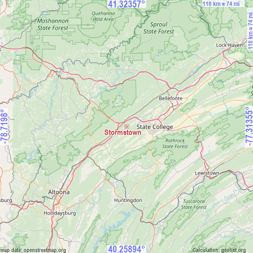
Stormstown GPS coordinates[2]
40° 47' 36.204" North, 78° 1' 0.012" West
| Map corner | latitude | longitude |
|---|---|---|
| Upper-left | 41.32357°, | -78.7198° |
| Center: | 40.79339°, | -78.01667° |
| Lower-right: | 40.25894°, | -77.31355° |
| Map W x H: | 118.4×118.4 km | = 73.6×73.6mi |
| max Lat: | 71.29058° ⇑37% North |
| Stormstown: | 40.79339° |
| min Lat: | ⇓63% South 19.06759° |
| min Long | Stormstown | max Long |
| -171.73463° | -78.01667° | -66.98998° |
| W 77.8%⇐ | ⇒22.2% E |
Elevation
Elevation of Stormstown is 407 m = 1335 ft, and this is 112.2 m = 368 ft above average elevation for this country.
| Max E: |
3189 m = 10463 ft | 15.9% |
| Stormstown | 407 m 1335 ft | |
| Avg. | 294.8 m = 967 ft | |
Min E: |
-60 m = -197 ft | 84.1% |
See also: United States elevation on elevation.city.
Geographical zone
Stormstown is located in North temperate zone (between Tropic of Cancer and the Arctic Circle). Distance of this Northern Tropic circle is 1929.9 km =1199.2 mi to South.| Distance of | km | miles | from Stormstown |
|---|---|---|---|
| North Pole | 5471.3 | 3399.7 | to North |
| Arctic Circle | 2865.4 | 1780.5 | to North |
| Tropic Cancer | 1929.9 | 1199.2 | to South |
| Equator | 4535.8 | 2818.4 | to South |


Nearby cities:
15 places around Stormstown: (largest is in red/bold)
• Boalsburg
19 km =11.8 mi,  95°
95°
• Chester Hill
20.8 km =12.9 mi,  301°
301°
• Hawk Run
21.6 km =13.4 mi,  312°
312°
• Houserville
16.2 km =10.1 mi,  77°
77°
• Lemont
16.8 km =10.4 mi, 83°
• North Philipsburg
20.5 km =12.7 mi, 308°
• Osceola Mills
22.3 km =13.9 mi,  286°
286°
• Park Forest Village
8.5 km =5.3 mi, 79°
• Philipsburg
20.6 km =12.8 mi, 303°
• Pine Grove Mills
12.9 km =8 mi,  121°
121°
• Port Matilda
3.2 km =2 mi,  282°
282°
• Ramblewood
9.7 km =6 mi,  148°
148°
• State College
13.2 km =8.2 mi,  90°
90°
• Toftrees
12 km =7.5 mi,  72°
72°
• Troy
21.6 km =13.4 mi, 308°
Sources, notices
• [Note1] Compared only with cities in United States existing in our database
• [Src1] Map data: © OpenStreetMap contributors (CC-BY-SA)
• [Src2] Other city data from geonames.org with taken over terms of usage.
• [Src3] Geographical zone / Annual Mean Temperature by Robert A. Rohde @ Wikipedia
