Wilkes-Barre geodata
Wilkes-Barre (Pennsylvania) is a populated place; located in United States in America/New_York (GMT-4) time zone. With population of 40,780 people, there are 1184 cities with bigger population in this country. Compared to other cities in United States, 68.3% of cities are located further ↓South; 84.5% of cities are located further ←West and 56.8% of cities have higher elevation than Wilkes-Barre. Note1
Administrative division(s):
- Level 1: Pennsylvania
- Level 2: Luzerne County
- Level 3: City of Wilkes-Barre


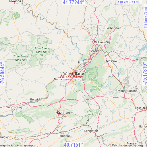
Wilkes-Barre GPS coordinates[2]
41° 14' 45.276" North, 75° 52' 52.716" West
| Map corner | latitude | longitude |
|---|---|---|
| Upper-left | 41.77244°, | -76.58444° |
| Center: | 41.24591°, | -75.88131° |
| Lower-right: | 40.7151°, | -75.17819° |
| Map W x H: | 117.6×117.6 km | = 73.1×73.1mi |
| max Lat: | 71.29058° ⇑31.7% North |
| Wilkes-Barre: | 41.24591° |
| min Lat: | ⇓68.3% South 19.06759° |
| min Long | Wilkes-Barre | max Long |
| -171.73463° | -75.88131° | -66.98998° |
| W 84.5%⇐ | ⇒15.5% E |
Elevation
Elevation of Wilkes-Barre is 172 m = 564 ft, and this is 122.8 m = 403 ft below average elevation for this country.
| Max E: |
3189 m = 10463 ft | 56.8% |
| Avg. | 294.8 m = 967 ft | |
| Wilkes-Barre | 172 m = 564 ft | |
Min E: |
-60 m = -197 ft | 43.2% |
See also: Wilkes-Barre elevation on elevation.city.
Geographical zone
Wilkes-Barre is located in North temperate zone (between Tropic of Cancer and the Arctic Circle). Distance of this Northern Tropic circle is 1980.2 km =1230.4 mi to South.| Distance of | km | miles | from Wilkes-Barre |
|---|---|---|---|
| North Pole | 5420.9 | 3368.4 | to North |
| Arctic Circle | 2815.1 | 1749.2 | to North |
| Tropic Cancer | 1980.2 | 1230.4 | to South |
| Equator | 4586.1 | 2849.7 | to South |


Nearby cities:
15 places around Wilkes-Barre: (largest is in red/bold)
• Ashley
4.2 km =2.6 mi,  197°
197°
• Courtdale
4.6 km =2.9 mi,  325°
325°
• Edwardsville
3.9 km =2.4 mi,  311°
311°
• Forty Fort
3.7 km =2.3 mi,  3°
3°
• Georgetown
2.3 km =1.4 mi,  153°
153°
• Hilldale
6.1 km =3.8 mi,  37°
37°
• Hudson
5 km =3.1 mi,  49°
49°
• Kingston
2.2 km =1.4 mi,  323°
323°
• Larksville
4.1 km =2.5 mi,  268°
268°
• Laurel Run
3 km =1.9 mi, 149°
• Luzerne
4.7 km =2.9 mi,  339°
339°
• Plains
4.2 km =2.6 mi, 38°
• Plymouth
5.3 km =3.3 mi,  263°
263°
• Pringle
3.8 km =2.4 mi, 339°
• Swoyersville
5.1 km =3.2 mi,  6°
6°
Sources, notices
• [Note1] Compared only with cities in United States existing in our database
• [Src1] Map data: © OpenStreetMap contributors (CC-BY-SA)
• [Src2] Other city data from geonames.org with taken over terms of usage.
• [Src3] Geographical zone / Annual Mean Temperature by Robert A. Rohde @ Wikipedia
