North Smithfield geodata
North Smithfield (Rhode Island) is a populated place; located in United States in America/New_York (GMT-4) time zone. With population of 11,212 people, there are 4117 cities with bigger population in this country. Compared to other cities in United States, 75.4% of cities are located further ↓South; 96.5% of cities are located further ←West and 69.2% of cities have higher elevation than North Smithfield. Note1
Administrative division(s):
- Level 1: Rhode Island
- Level 2: Providence County
- Level 3: Town of North Smithfield


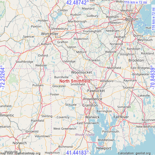
North Smithfield GPS coordinates[2]
41° 58' 0.372" North, 71° 32' 58.236" West
| Map corner | latitude | longitude |
|---|---|---|
| Upper-left | 42.48742°, | -72.25264° |
| Center: | 41.96677°, | -71.54951° |
| Lower-right: | 41.44183°, | -70.84639° |
| Map W x H: | 116.3×116.3 km | = 72.3×72.3mi |
| max Lat: | 71.29058° ⇑24.6% North |
| North Smithfield: | 41.96677° |
| min Lat: | ⇓75.4% South 19.06759° |
| min Long | North Smithfiel | max Long |
| -171.73463° | -71.54951° | -66.98998° |
| W 96.5%⇐ | ⇒3.5% E |
Elevation
Elevation of North Smithfield is 105 m = 344 ft, and this is 189.8 m = 623 ft below average elevation for this country.
| Max E: |
3189 m = 10463 ft | 69.2% |
| Avg. | 294.8 m = 967 ft | |
| North Smithfield | 105 m = 344 ft | |
Min E: |
-60 m = -197 ft | 30.8% |
See also: United States elevation on elevation.city.
Geographical zone
North Smithfield is located in North temperate zone (between Tropic of Cancer and the Arctic Circle). Distance of this Northern Tropic circle is 2060.3 km =1280.2 mi to South.| Distance of | km | miles | from North Smithfield |
|---|---|---|---|
| North Pole | 5340.8 | 3318.6 | to North |
| Arctic Circle | 2734.9 | 1699.4 | to North |
| Tropic Cancer | 2060.3 | 1280.2 | to South |
| Equator | 4666.3 | 2899.5 | to South |


Nearby cities:
15 places around North Smithfield: (largest is in red/bold)
• Bellingham
14.7 km =9.1 mi,  24°
24°
• Blackstone
5.7 km =3.5 mi,  6°
6°
• Chepachet
11.6 km =7.2 mi,  240°
240°
• Cumberland
9.6 km =6 mi,  90°
90°
• Cumberland Hill
6.9 km =4.3 mi,  82°
82°
• Greenville
10.6 km =6.6 mi,  181°
181°
• Harmony
9.6 km =6 mi,  204°
204°
• Harrisville
10.3 km =6.4 mi,  269°
269°
• Lincoln
10.7 km =6.6 mi,  118°
118°
• Millville
7.3 km =4.5 mi,  339°
339°
• Pascoag
12.7 km =7.9 mi,  264°
264°
• Smithfield
5 km =3.1 mi, 180°
• Uxbridge
14 km =8.7 mi,  331°
331°
• Valley Falls
14.7 km =9.1 mi, 116°
• Woonsocket
4.9 km =3 mi,  35°
35°
Sources, notices
• [Note1] Compared only with cities in United States existing in our database
• [Src1] Map data: © OpenStreetMap contributors (CC-BY-SA)
• [Src2] Other city data from geonames.org with taken over terms of usage.
• [Src3] Geographical zone / Annual Mean Temperature by Robert A. Rohde @ Wikipedia
