Milltown geodata
Milltown (Wisconsin) is a populated place; located in United States in America/Chicago (GMT-5) time zone. With population of 883 people, there are 17089 cities with bigger population in this country. Compared to other cities in United States, 94.1% of cities are located further ↓South; 65.2% of cities are located further →East and 82.2% of cities have lower elevation than Milltown. Note1


Milltown GPS coordinates[2]
45° 31' 33.852" North, 92° 30' 30.708" West
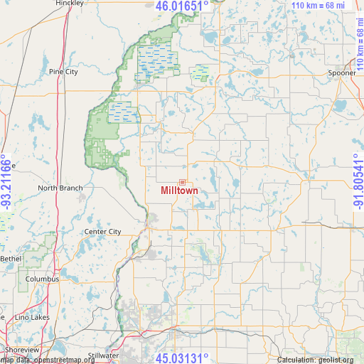
| Map corner | latitude | longitude |
|---|---|---|
| Upper-left | 46.01651°, | -93.21166° |
| Center: | 45.52607°, | -92.50853° |
| Lower-right: | 45.03131°, | -91.80541° |
| Map W x H: | 109.5×109.5 km | = 68×68mi |
| max Lat: | 71.29058° ⇑5.9% North |
| Milltown: | 45.52607° |
| min Lat: | ⇓94.1% South 19.06759° |
| min Long | Milltown | max Long |
| -171.73463° | -92.50853° | -66.98998° |
| W 34.8%⇐ | ⇒65.2% E |
Elevation
Elevation of Milltown is 379 m = 1243 ft, and this is 84.2 m = 276 ft above average elevation for this country.
| Max E: |
3189 m = 10463 ft | 17.8% |
| Milltown | 379 m 1243 ft | |
| Avg. | 294.8 m = 967 ft | |
Min E: |
-60 m = -197 ft | 82.2% |
See also: United States elevation on elevation.city.
Geographical zone
Milltown is located in North temperate zone (between Tropic of Cancer and the Arctic Circle). Distance of this North polar circle is 2339.1 km =1453.4 mi to North.| Distance of | km | miles | from Milltown |
|---|---|---|---|
| North Pole | 4945 | 3072.7 | to North |
| Arctic Circle | 2339.1 | 1453.4 | to North |
| Tropic Cancer | 2456.1 | 1526.1 | to South |
| Equator | 5062 | 3145.4 | to South |


Nearby cities:
15 places around Milltown: (largest is in red/bold)
• Amery
26.9 km =16.7 mi,  154°
154°
• Balsam Lake
9.2 km =5.7 mi, 152°
• Center City
28.2 km =17.5 mi,  238°
238°
• Centuria
9 km =5.6 mi,  203°
203°
• Clam Falls
24.6 km =15.3 mi,  42°
42°
• Dresser
21.3 km =13.2 mi,  207°
207°
• Frederic
15.1 km =9.4 mi,  12°
12°
• Grantsburg
30.9 km =19.2 mi,  334°
334°
• Lindstrom
30.5 km =19 mi, 240°
• Luck
5.9 km =3.7 mi,  19°
19°
• Osceola
27.5 km =17.1 mi, 213°
• Saint Croix Falls
16.5 km =10.3 mi,  218°
218°
• Shafer
24.2 km =15 mi,  230°
230°
• Siren
30.5 km =19 mi, 18°
• Taylors Falls
17.8 km =11.1 mi, 219°
Sources, notices
• [Note1] Compared only with cities in United States existing in our database
• [Src1] Map data: © OpenStreetMap contributors (CC-BY-SA)
• [Src2] Other city data from geonames.org with taken over terms of usage.
• [Src3] Geographical zone / Annual Mean Temperature by Robert A. Rohde @ Wikipedia
